This item has been sold, but you can get on the Waitlist to be notified if another example becomes available, or purchase a digital scan.
1860 Schedler Pocket Map of Lake Constance (Bodensee)
Bodensee-schedler-1860$225.00

Title
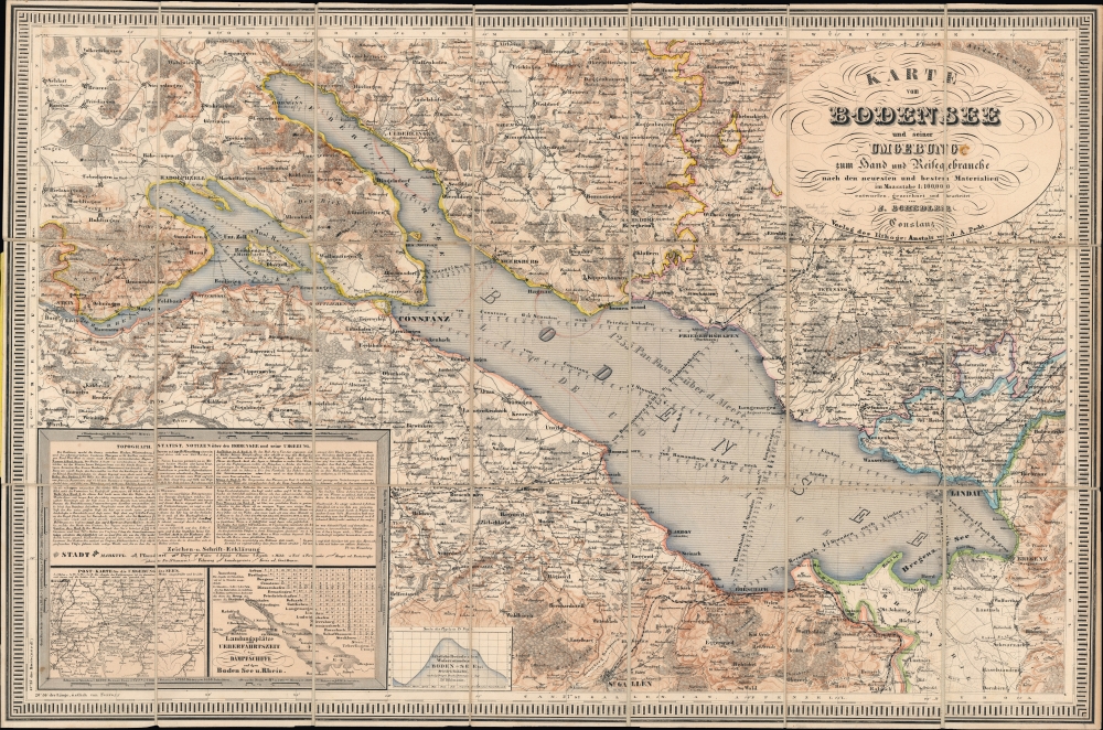
Karte vom Bodensee und seiner Umgebung zum Hand und Reisegebrauche nach den neuesten und besten Materialien.
1860 (undated) 19.75 x 29.75 in (50.165 x 75.565 cm) 1 : 100000
1860 (undated) 19.75 x 29.75 in (50.165 x 75.565 cm) 1 : 100000
Description
A stunning hand-colored c. 1860 pocket folding map of Lake Constance (the Bodensee) and environs on the German-Swiss-Austrian border by J. Schedler, perhaps Joseph Schedler, who emigrated to the United States and worked there as a cartographer.
A box at bottom-left includes a legend, a block of text discussing the lake's topography, history, statistics, climate, and so on, and two inset maps, one being a road map of the surrounding region as far as Strasbourg, Freiburg, Basel, and Bern, and the other being a map and table of the docking points and time of travel for steamships across the Bodensee. Next to this large box is a smaller table displaying variations in the water level in the lake by month.
A Closer Look
Coverage includes the lake in its entirety, including the smaller 'Untersee' at left and the Rhine River (Seerhein, here simply as 'Der Rhein'), which begins its long flow to the North Sea from Lake Constance. Routes between cities and major stopping points along the lake are traced, with soundings noted along the route. Surrounding the lake, cities, towns, roads of various types and quality, railways, religious sites, spas, vista points (fernsicht), and more are labeled. The city of Constance (also as Konstanz in the German style, or here as 'Constanz') is prominent at left center, at the confluence of the Untersee and the main part of the lake (Obersee). The northwestern 'finger' of the Obersee is here labeled Überlingersee (Lake Überlingen) after the German city on its northern bank.A box at bottom-left includes a legend, a block of text discussing the lake's topography, history, statistics, climate, and so on, and two inset maps, one being a road map of the surrounding region as far as Strasbourg, Freiburg, Basel, and Bern, and the other being a map and table of the docking points and time of travel for steamships across the Bodensee. Next to this large box is a smaller table displaying variations in the water level in the lake by month.
Konstanz - Straddling Germany and Switzerland
Though surrounded by Swiss territory on its southern side, Konstanz was an imperial city of the Holy Roman Empire and a member of the Swabian League. In the 15th century, the city attempted to join the Swiss Confederacy, but was blocked by rural cantons, which feared dominance of the Confederacy by cities. Therefore, Konstanz joined the German Empire when it was officially founded in 1871, while maintaining its identity as a meeting point of multiple cultures.Publication History and Census
This map was drawn by J. Schedler and published by Anstalt von J. A. (Johann Andreas) Pecht. It is undated, but from context, namely the railways present, appears to date from c. 1860 (it lacks the High Rhine Railway - Hochrheinbahn - which reached Konstanz in 1863). Schedler may be Joseph Schedler, who emigrated to the United States after the Revolutions of 1848 and published some impressive maps, including ones relating to the U.S. Civil War. The lack of railways in the legend despite their presence on the map itself suggests that this was a later printing, in which case Schedler could have made the first edition before emigrating. This interpretation is supported by examining digitized examples held by the Bibliothèque nationale de France and Vorarlberger Landesbibliothek, dated to c. 1845, in which rail lines are not present. Regardless of edition, this map is quite rare, being held by the Bibliothèque nationale de France and eight institutions in Germany and Switzerland.CartographerS
Joseph Schedler (April 22 1813 - December 12, 1887) was a New York based engraver, printer, lithographer, and globe maker active from about 1850 to at least 1889. Schedler was born in Germany and immigrated to the United States, a Forty-Eighter fleeing the German Revolutions of 1848-1849. He was active from at least 1850 when he partnered with fellow German immigrant, the landscape artist, painter, and engraver, Theodore August Liebler (1830 – 18??), to found the lithography firm of Schedler and Liebler, 129 William Street. The firm completed engraving work for J. H. Colton as early as 1852 but probably dissolved by 1854. Schedler filed a patent in 1878 for a crystallotype machine, a device the employed electrotyping to print textured crystalline surfaces. He is best known today as a globe maker. Joseph Schedler's globes won prizes at the Paris International Exhibition in 1867, the American Institute Fair in 1869 and the Vienna International Exhibition in 1873. From at least 1876 records suggest he relocated to Jersey City, New Jersey. Schedler's son, Herman, was also a globe maker, and inherited his father's business sometime around 1877, producing globes will to about 1901. More by this mapmaker...
Johann Andreas Pecht (1773 - 1852) was a German lithographer, printer, bookseller, and journalist based on Konstanz (Constance). He drew and published in a variety of subjects, including scenes of Lake Constance (the Bodensee), and appears to have been an early adopter of lithography over engraved copper or steel plates. Learn More...
Condition
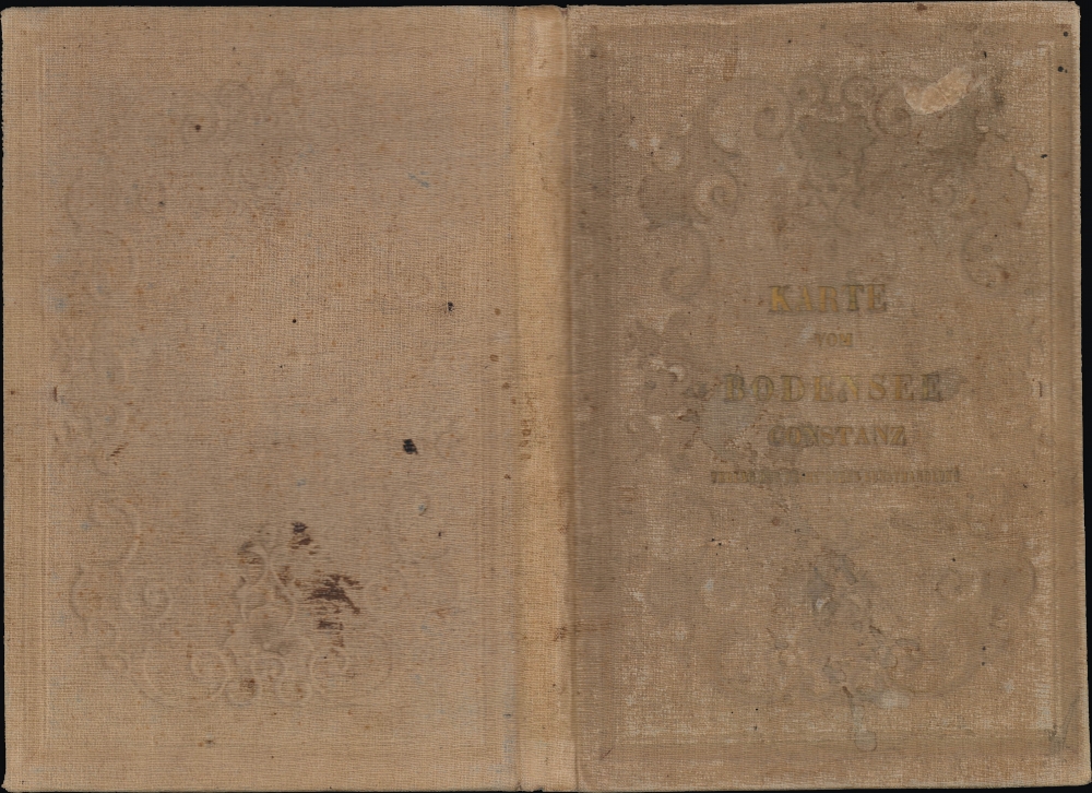
Very good. Panels mounted on linen. Red markings in lake region. Light soiling and foxing.
References
OCLC 494649955, 1176816012, 637488060, 862954844, 984924855.