This item has been sold, but you can get on the Waitlist to be notified if another example becomes available.
1955 Interstate Publishing Company City Map of Brooklyn, New York
BoroughBrooklyn-interstatepublishing-1955$125.00

Title
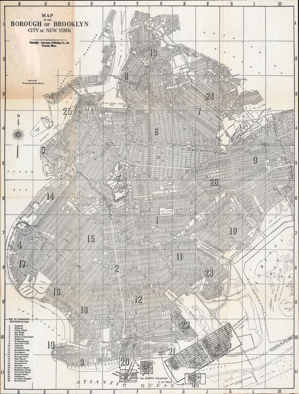
Map of the Borough of Brooklyn City of New York.
1955 (undated) 21 x 16 in (53.34 x 40.64 cm) 1 : 36000
1955 (undated) 21 x 16 in (53.34 x 40.64 cm) 1 : 36000
Description
This is a 1955 Interstate Publishing Company city plan or map of Brooklyn, New York. Depicting the entirety of the borough, twenty-six neighborhoods are numerically identified (although not delineated with 'borders') and correspond to a key situated in the lower left corner. Among these neighborhoods are Flatbush, Coney Island, Bedford-Stuyvesant, Greenpoint, Bay Ridge, Williamsburg, and Brooklyn Heights. Streets are labeled throughout the borough, as are parks, including Prospect Park and Fort Green Park. 'Inserts' near the bottom border detail two sections of Brighton Beach and a section of Manhattan Beach.
Publication History
This map was created and published by the Interstate Publishing Company in 1955. This map is not cataloged in OCLC and we have been unable to locate any other surviving examples.Condition
Very good. Exhibits toning where once attached to original binder. Exhibits light wear along original fold lines.