This item has been sold, but you can get on the Waitlist to be notified if another example becomes available, or purchase a digital scan.
1901 Hobbs Map or Plan of Boston, Massachusetts
Boston-hobbs-1901$100.00

Title
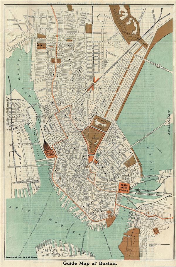
Guide Map of Boston.
1901 (dated) 21 x 14 in (53.34 x 35.56 cm) 1 : 10000
1901 (dated) 21 x 14 in (53.34 x 35.56 cm) 1 : 10000
Description
This is an attractive 1901 tourist map or plan of the city of Boston, Massachusetts by C. W. Hobbs. Oriented to the southeast, it covers the city from Boston Harbor to Back Bay Park and includes parts of South Boston, East Boston and Charlestown. The map notes city streets, parks, squares, individual buildings, railway lines and stations. Other topographical features are also noted. This map was issued as a Vest Pocket Guide and Map of Boston by C.W. Hobbs in 1901.
Condition
Very good. Minor wear along original fold lines. Professionally flattened and backed with archival tissue.