This item below is out of stock, but another example (left) is available. To view the available item, click "Details."
Details
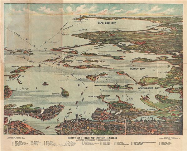
1920 Union News View Map of Boston Harbor and Cape Cod, Massachusetts
1920 (undated) $350.00
1920 Union News Company View Map of Boston Harbor and Cape Cod, Massachusetts
BostonHarbor3-unionnews-1920$150.00

Title
Bird's Eye View of Boston Harbor Along the South Shore to Provincetown.
1920 (undated) 16.5 x 20 in (41.91 x 50.8 cm)
1920 (undated) 16.5 x 20 in (41.91 x 50.8 cm)
Description
This is a remarkable 1920 chromolithograph map and view of the Boston Harbor from Boston to Provincetown. It covers all of Cape Cod Bay, Quincy Bay and Dorchester Bay with the communities of Boston, east Boston, south Boston, Dorchester, Quincy, Hough's Neck, Mingham, Nantucket, Duxbury, Plymouth, Cohasset, Scituate, and Provincetown noted. Many of the islands in Boston Harbor, including Moon Island, Spectacle Island, Thomson's Island, Long Island, Governor's Island, and others are also identified. An index in the bottom margin lists several other important places identified on the map. Ferry and steamboat routes are noted throughout.
This view copyrighted by the Union News Company is based upon the late 19th century view of John Murphy. This view was engraved and printed by the Federal Engraving Co., and published by the Union News Company, Boston, Mass.
This view copyrighted by the Union News Company is based upon the late 19th century view of John Murphy. This view was engraved and printed by the Federal Engraving Co., and published by the Union News Company, Boston, Mass.
Condition
Very good. Minor wear along original fold lines. Some toning near top left quadrant. Minor spotting. Professionally flattened and backed with archival tissue.

