
This item below is out of stock, but another example (left) is available. To view the available item, click "Details."
Details
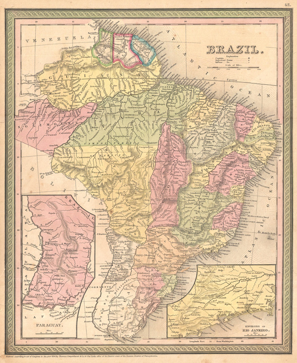
1854 Mitchell Map of Brazil
1854 (dated 1850) $150.00
1850 Mitchell Map of Brazil w/ inset of Rio de Janeiro
BrazilEtc-mitchell-1850$50.00

Title
Brazil.
1850 (dated) 15.5 x 12.5 in (39.37 x 31.75 cm)
1850 (dated) 15.5 x 12.5 in (39.37 x 31.75 cm)
Description
A nice example of S. A. Mitchell's 1850 map of Brazil and Paraguay. This map depicts the eastern part of South American including the Guianas, Brazil ( Brasil ) and Paraguay. Features impressive detail of the amazon basin and the interior of Brazil. Inset of the Environs of Rio de Jenario at the bottom Left. Inset of Paraguay at the bottom right. Published as plate no. 42 in the 1850 edition of Mitchell's New Universal Atlas.
Cartographer
Samuel Augustus Mitchell (March 20, 1792 - December 20, 1868) began his map publishing career in the early 1830s. Mitchell was born in Bristol, Connecticut. He relocated to Philadelphia in 1821. Having worked as a school teacher and a geographical writer, Mitchell was frustrated with the low quality and inaccuracy of school texts of the period. His first maps were an attempt to rectify this problem. In the next 20 years Mitchell would become the most prominent American map publisher of the mid-19th century. Mitchell worked with prominent engravers J. H. Young, H. S. Tanner, and H. N. Burroughs before attaining the full copyright on his maps in 1847. In 1849 Mitchell either partnered with or sold his plates to Thomas, Cowperthwait and Company who continued to publish the Mitchell's Universal Atlas. By about 1856 most of the Mitchell plates and copyrights were acquired by Charles Desilver who continued to publish the maps, many with modified borders and color schemes, until Mitchell's son, Samuel Augustus Mitchell Junior, entered the picture. In 1859, S.A. Mitchell Jr. purchased most of the plates back from Desilver and introduced his own floral motif border. From 1860 on, he published his own editions of the New General Atlas. The younger Mitchell became as prominent as his father, publishing maps and atlases until 1887, when most of the copyrights were again sold and the Mitchell firm closed its doors for the final time. More by this mapmaker...
Source
Mitchell Sr., S. A.,A New Universal Atlas Containing Maps of the various Empires, Kingdoms, States and Republics Of The World. (1850 issue)
Condition
Good. Even overall toning.