This item has been sold, but you can get on the Waitlist to be notified if another example becomes available, or purchase a digital scan.
1895 Map of the World of the British Empire, w/ shipping routes and ocean currents
BritishEmpire-andree-1895$62.50

Title
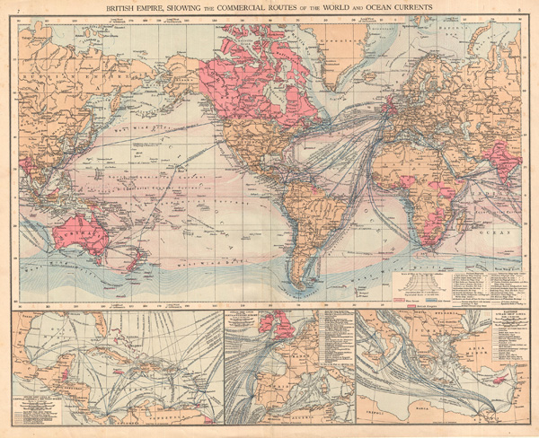
British Empire, showing the commercial routes of the world and ocean currents
1895 (undated) 15.5 x 19 in (39.37 x 48.26 cm)
1895 (undated) 15.5 x 19 in (39.37 x 48.26 cm)
Description
This beautiful colored map of the British Empire in 1895 show the commercial routes of the world and ocean currents. Includes three insets detailing steamship lines in 1) Central America & the West Indies, 2)Western Europe, and 3) the eastern Mediterranean. Areas under British control are highlighted in Red These include Australia, Belize, parts of Africa, Cyprus, India, New Zealand, parts of Borneo and New Guinea, and the British Island themselves. Published for the London Times by Cassell and Co. as plate no. 8 in the 1895 Times Atlas of the World.
Source
Andree, R., The Times Atlas of the World, (London) 1895.
Condition
Good
References
Rumsey 1010.005. Espenhorst, J., Petermann's Planet, v. 1 p. 610-613.