
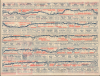
1942 Highway Travel Service Promotional Strip Map, the 'Broadway of America'

This item has been sold.
The Broadway of America The Transcontinental Highway San Diego to New York.
Cross-country Travel before the Interstates.
- Digital Map Information
- Suitable for large format printing
- Full resolution TIFF file
- ICC color profile embedded
- Delivered instantly via download link
Cross-country Travel before the Interstates.
This is an unrecorded 1942 promotional strip map of the 'Broadway of America,' issued by the Highway Travel Service. The map covers large portions of U.S. Routes 1, 11, 67, 70, and 80, along with smaller portions of other highways. The map underscores the significance of highways as part of the World War II mobilization efforts. It moreover marks an intermediary stage between early highways and their booster associations and the modern-day interstate system.A Closer Look
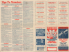
The map consists of five horizontal strips covering a route across the country between San Diego and Roanoke, Virginia, and then up the East Coast to New York City. Cities and towns are marked all along the route, with the distances between each recorded. Arrows and red text indicate cafes, restaurants, accommodations, and services along the route, with fuller advertisements in the spaces between each row of the map and on the verso. The route (going from west to east) uses U.S. Route 80 from San Diego to Dallas, Route 67 from Dallas to Little Rock, Route 70 from Little Rock to Knoxville, Route 11/211 from Knoxville to Washington, D.C., and Route 1 up the coast from Washington, D.C., to New York City. The slogan 'the Broadway of America' was more often used exclusively for U.S.-70, but the makers of this map clearly saw it as a fitting and catchy tagline for the entire route.One interesting feature of the route is the New Castle-Pennsville Ferry across the Delaware River, connecting the Delaware and New Jersey Turnpikes. At this time, travelers between Delaware and New Jersey had to transit via Philadelphia to cross the Benjamin Franklin Memorial Bridge (opened 1926), potentially adding hours to their trip. The ferry remained the only means for an automobile to cross the Delaware River in the vicinity of New Castle / Wilmington until the Delaware Memorial Bridge was completed in 1951.
The map should be considered in the context of World War II (1939 - 1945). Even at this early stage, the war made clear the importance of highways, as trucks and military equipment had trouble moving long-distances on narrow roads while intermingled with regular traffic, just as World War I had necessitated the earliest national plan for a road network of any sort after a U.S. Army Motor Corps famously struggled for 62 days to cross the country on existing roads. That convoy included a young Dwight D. Eisenhower, who later commanded Allied troops in Europe during World War II and saw the benefits of the pioneering German Reichsautobahn system. As President, Eisenhower prioritized the construction of a nationwide interstate highway system, embodied in the Federal-Aid Highway Act of 1956.
Highway Associations
The movement promoting the construction of 'good quality' roads did not begin with the invention of the automobile, but rather with the bicycle. At the time, most interurban roads were unpaved and impractical for cycling. The 'Good Roads Movement' was inaugurated in May 1880 to advocate for bicycle enthusiasts, riding clubs, and manufacturers. By 1910, the American Automobile Association (AAA) had jumped on board, along with over 100 other local and national organizations. 'Road booster' organizations emerged to promote specific, often branded, highways. By the 1920s, about 250 'named' highways, each with its own boosters, crossed the United States. 'Road boosters' still exist, but most disbanded in the 1950s and 60s with the emergence of the federally-funded Interstate Highway System. The present map is somewhat unusual in that it is issued by a private map publisher rather than a 'booster' highway association.Publication History and Census
This map was issued by the Highway Travel Service, a map publisher based in Waterloo, Iowa, which produced several maps of long-distance U.S. Routes under the title 'Tips to Travelers' (for comparison, see our US66-highwaytravel-1952 or Rumsey 15324.002). This map is unrecorded in institutional collections, and we have been unable to uncover any market history.Cartographer
Highway Travel Service (fl. c. 1935 - 1952), later the Highway Travel Agency, was a map publisher based in Waterloo, Iowa. It primarily issued strip maps of long-distance highways, especially U.S. Routes, under the title 'Tips to Travelers,' followed by the particular route in question. Their maps are conceptually similar to those produced by nonprofit highway associations, but maintained a distinctive style, employing a multi-layered strip map with the layers separated by a row of advertisements for businesses in that vicinity of that section of the highway. Their maps appear to have been sold at gas stations along the routes in question, but likely had a limited distribution as they are quite scarce today. Further Details...
Condition
Very good. Some bleed through.