
1962 Dolph City Plan or Map of Orlando and Vicinity, Florida

This item has been sold.
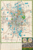
Map of Greater Orlando Winter Park and Maitland Florida / Dolph's Indexed Street Map Orlando Winter Park - Maitland and Orange County Florida.
Orlando on the Eve of the Disney Boom.
Orlando on the Eve of the Disney Boom.
This is a c. 1965 Frank B. Dolph city plan or map of Orlando, Winter Park, and vicinity in Florida. It depicts the area in the early phase of a period of rapid growth, caught between the disappearing world of railroads and the emerging world of interstates and larger airports for long-distance jetliners.A Closer Look
This map covers the developed portion of Orlando, Florida, along with nearby suburbs Winter Park and Maitland while the survey-style 'Map of Orange County' on the verso covers a wider area. Streets and highways are traced throughout, with highways and major roads shaded red, as are hospitals and airports. The Atlantic Coast Line Railroad and Seaboard Air Line Railroad are clearly traced, with the new Interstate-4 largely following or paralleling the route of the former. Golf courses, park land, cemeteries, schools, and military bases are shaded green, while waterways, including the area's prodigious number of lakes (several of which have changed names in subsequent years) are shaded blue, with the city's residential and commercial areas shaded light blue. The city limits of Orlando are traced in a black dashed line. (These expanded considerably in following decades to incorporate nearby lands.) Local landmarks such as the Tangerine Bowl Stadium (later the Citrus Bowl, now known as Camping World Stadium) and the adjacent Tinker Field (torn down in 2015) are clearly indicated. A grid surrounds the map, and corresponds with a street index at the bottom and continues on the verso.Orlando's Airports
As a growing city with a strong military history and, not long after this map's publication, an international tourist destination, Orlando has long maintained impressive aerial infrastructure. The airfield noted here as Herndon Field is today's Orlando Executive Airport, a convenient option given its proximity to downtown Orlando. Today's Orlando International Airport is just beyond the scope of the map to the southeast and was then McCoy Air Force Base (seen on the verso map. The 'Orlando Air Force Base' marked at right here near Lake Corrine (now Lake Baldwin) was part of a large military facility that once covered a much wider area, including Herndon Field, simply known as 'Orlando Air Force Base.' After World War II, parts of this land were gradually broken off and dedicated to civilian use, which likely explains the continuation of the city's street plan into the grounds of the Air Force Base. In 1968, the area marked here as 'Orlando Air Force Base' was turned over to the Navy to become Naval Training Center Orlando, which contained the Naval Air Warfare Center Training Systems Division. In 1988, the center moved 15 miles to the east (beyond the scope of this map) and remains there today. In the years since, the former Air Force Base has been converted to commercial and residential use, including a Veterans' Affairs clinic.Historical Context
Like several other cities in Florida, Orlando first emerged as a proper city in the Florida Land Boom of the 1920s, witnessed the arrival of many new (if temporary) 'residents' during World War II, and enjoyed a second period of rapid growth in the Postwar period. Thus, a city of nearly 37,000 in 1940 almost tripled in population to roughly 100,000 by 1970. A city already on the rise, Orlando's growth was given even greater impetus when the Walt Disney World resort opened in 1971 at a location some 20 miles southwest of downtown (near Bay Lake, visible on the verso map). In time, the resort would become the linchpin of a wider regional economy spanning several counties.Publication History and Census
This map was prepared by the Dolph Map Company in 1961 or 1962. It is undated, but from context can be dated to the early 1960s. The inclusion of Interstate-4 (built in segments over many years), parts of which are ghosted in here and ultimately followed a different route (for instance, around Lake Killarney in Winter Park) might suggest a later date, as does the name 'Herndon Field,' adopted in 1961. Yet, McCoy Air Force Base retains its military name here; the airfield was converted to civilian use and became the Orlando Jetport in 1962. The OCLC only notes one example of a map with this title, held by the Bibliothèque nationale de France and dated to 1959.Cartographer
Frank B. Dolph (October 3, 1897 - November 26, 1975) was an American businessman and map publisher. Born in Great Neck, Long Island, New York, Dolph served as a Navy storekeeper during World War I. He began selling maps in 1919 after returning from England, likely for the George F. Cram Company, where he ultimately became an administrative aide. He also worked for the Rand McNally Company for some time before he founded his own map publishing firm, Dolph and Stewart, with his friend, sometime in the 1920s. Dolph and Stewart made maps throughout the 1920s and 1930s until they sold the firm in 1945 when Dolph decided to return to Florida. Dolph opened a new map publishing business, the Frank B. Dolph Map Co. in Ft. Lauderdale and published city plans of cities throughout the United States. Many of his maps were distributed by Chambers of Commerce or sold at newsstands. Real estate developers greatly appreciated his maps, those published by both the Dolph and Stewart Company and the Frank B. Dolph Company. Dolph retired as president of his firm around 1965, when he handed the business off to his son, Frank B. Dolph, Jr. Dolph worked with cartographer Theodore M. Politano for decades while operating the Frank B. Dolph Map Company. Further Details...
Condition
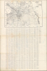
Average. Verso repairs to fold separations and at fold intersections. Closed tears extending 1 inch and 1.5 inches within printed area professionally repaired on verso. Index and a map of Orange County on verso.