This item has been sold, but you can get on the Waitlist to be notified if another example becomes available, or purchase a digital scan.
1920 Boeck City Plan or Map of Brussels, Belgium
Bruxelles-boeck-1920$100.00

Title
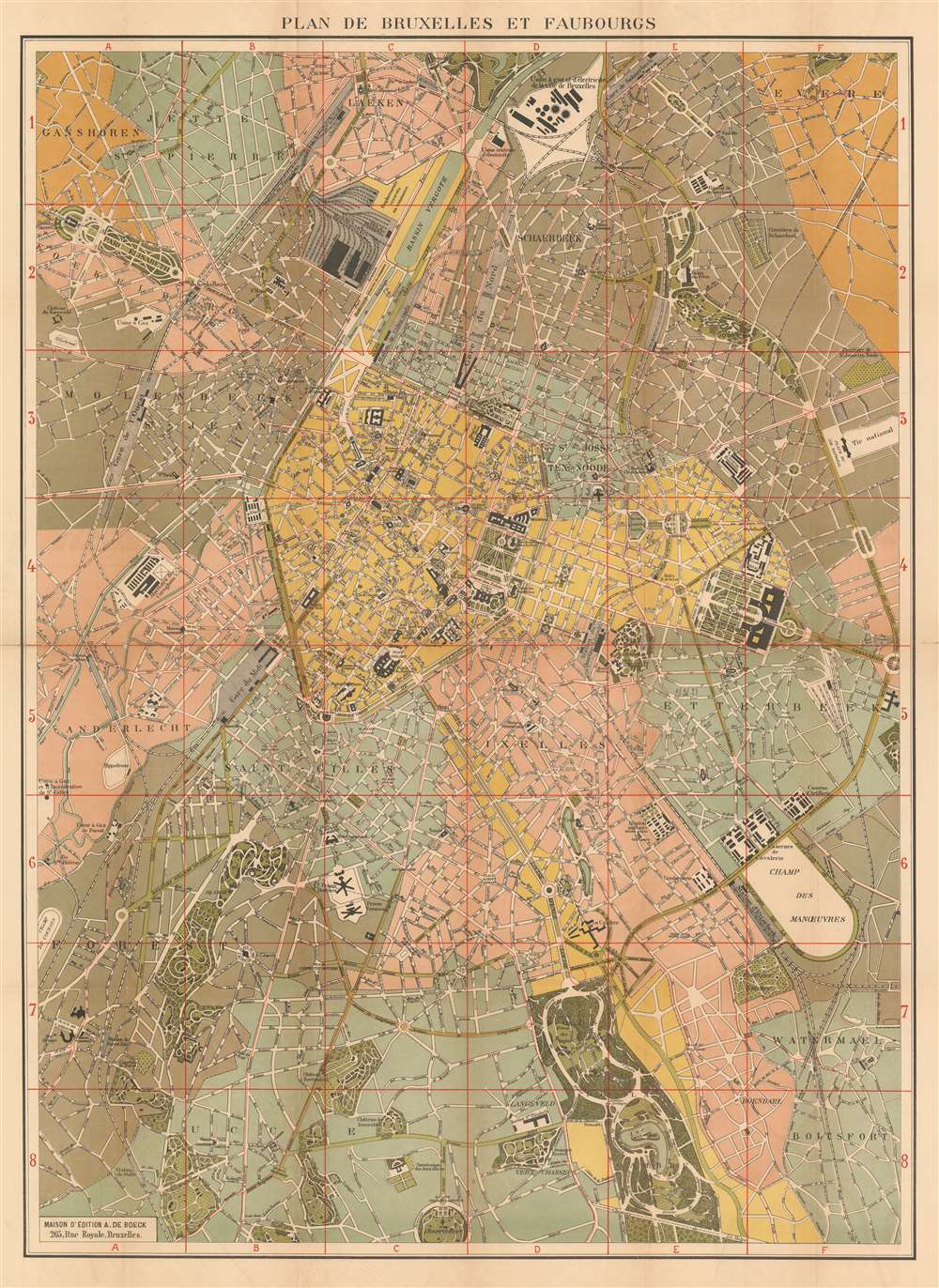
Plan de Bruxelles et Faubourgs.
1920 (undated) 32 x 23.5 in (81.28 x 59.69 cm) 1 : 12250
1920 (undated) 32 x 23.5 in (81.28 x 59.69 cm) 1 : 12250
Description
Published soon after the end of World War I, this is a c. 1920 Albert de Boeck city plan or map of Brussels / Bruxelles, Belgium. Important municipal buildings, including the king's palace, government ministries, and the law courts, are all labeled. City parks are illustrated in detail, as is the street network. The railroad stations are labeled, along with the city's slaughterhouses, racecourses, prisons, and universities.
Publication History
This map was created and published by Albert de Boeck c. 1920.Cartographer
Albert de Boeck (18xx - 19xx) founded A. de Boeck, a publishing company, in Belgium in 1885. Little is known about de Boeck himself, but the publishing firm still operates today, under the name De Boeck Supérieur. More by this mapmaker...
Condition
Good. Even overall toning. Light wear along original fold lines. Exhibits some offsetting.