This item has been sold, but you can get on the Waitlist to be notified if another example becomes available.
1945 U.S. Pacific Fleet WWII Report Detailing Northern Kyushu, Japan - Operation Downfall
BulletinNorthernKyushu-cincpac-1945$1,000.00


Title
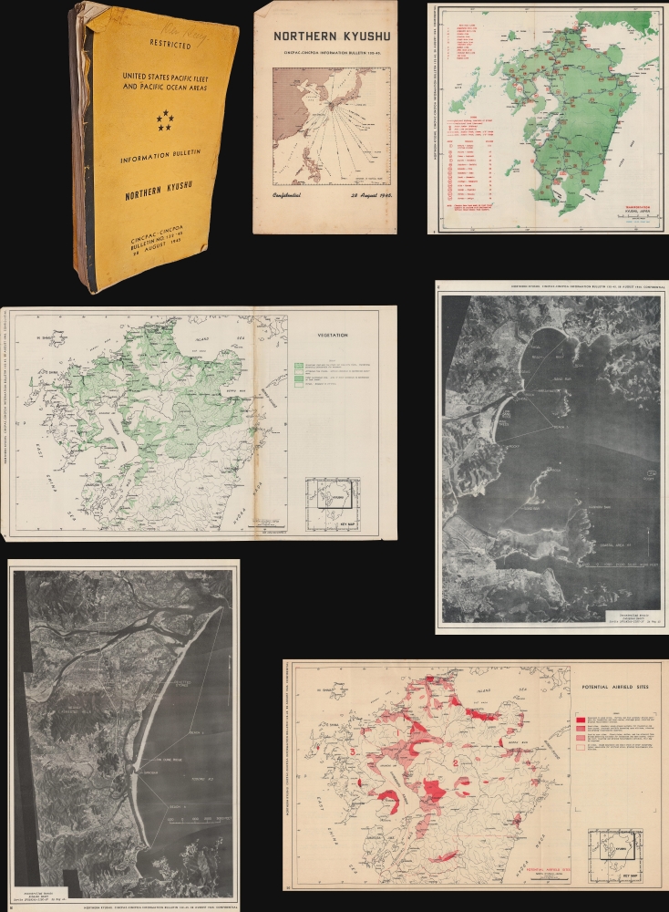
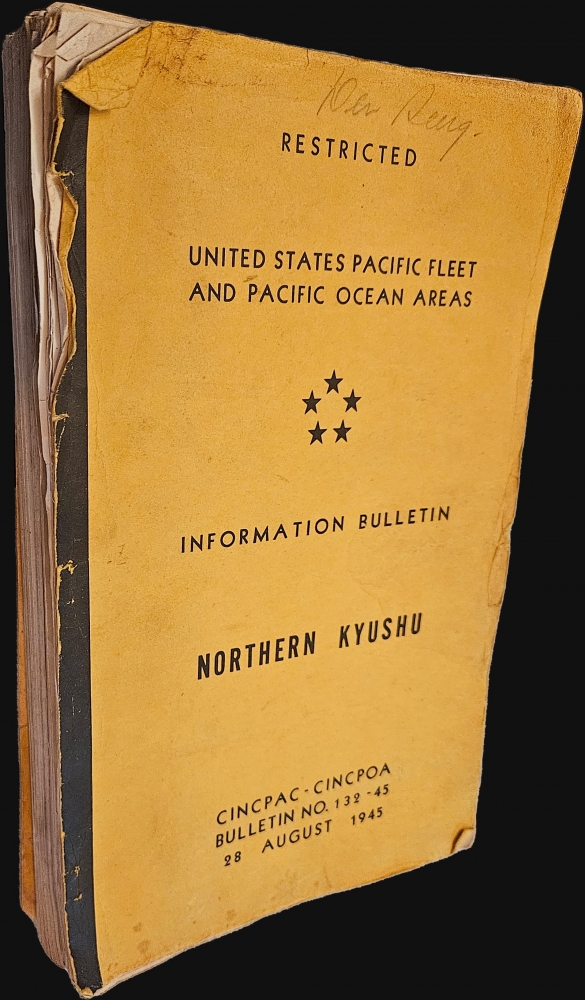
Restricted. United States Pacific Fleet and Pacific Ocean Areas. Information Bulletin. Northern Kyushu. CINCPAC-CINCPOA Bulletin No. 132-45. 28 August 1945.
1945 (dated) 13 x 8 in (33.02 x 20.32 cm)
1945 (dated) 13 x 8 in (33.02 x 20.32 cm)
Description
This is a 1945 United States Pacific Fleet report detailing northern Kyushu, prepared in advance for Operation DOWNFALL, the planned invasion of the Japanese Home Islands. With information current to June 1, 1945, this report was complete when the Japanese surrendered on August 15, 1945. Even though the war was over, the Pacific Fleet decided to publish the report, probably in the belief that it would help with the occupation. A short paragraph below the Table of Contents reads
The cessation of hostilities has permitted the reduction of classification of this bulletin from Confidential to Restricted. Consider the classification of 'Confidential' appearing on each page as changed accordingly.
Preparing to Invade Japan
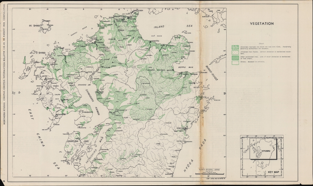
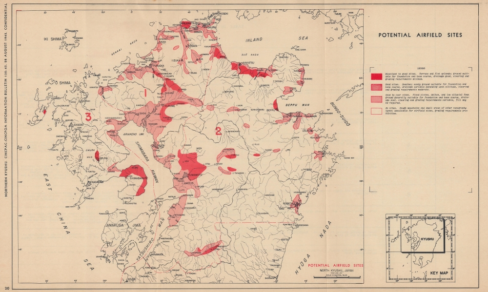
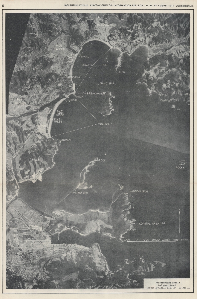
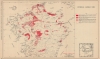
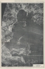
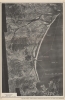
Per the reportThis bulletin is intended to present all available information of military value on the northern portion of the island of KYUSHU, including the FUKUOKA, NAGASAKI, SAGA, KUMAMOTO, and OTTA Prefectures, and the portion of MIYAZAKI Prefecture north of 32°27'N. This comprises all of the island not covered in the CINCPAC-CINCPOA Bulletin No. 81-45, 15 May 1945, on Southern KYUSHU. These are the first two of a series of bulletins on the Japanese home islands which will follow the area and prefecture breakdown outline in the Area Study Map.The present report provides a detailed overview of the northern half of the island, compiling maps, aerial photographs, tables, graphs, and other information. At 289 pages, the report begins with a series of fold out maps and aerial photographs. The first map encountered, the 'Area Study Map', provides a visual summary of how American reports will geographically divide Japan. This map is followed by a series of fold out maps of Kyushu and northern Kyushu. Among these are maps of the principal ports and industrial areas, transportation, topography, vegetation, soils, potential airfield sites, and beaches and terrain. As the report continues, specific sections are dedicated to various topics. The first is climatology, which includes line graphs showing temperature, precipitation, mean cloud amount, fog, thunderstorms, extratropical cyclones, and typhoons by month over the course of a year, sea and swell and tide charts, and maps of ocean currents of entire region (coast of China, Korea, all of Japan) for each month. Deeper in the report are sections dedicated to transportation (with 7 foldout maps and numerous foldout aerial photographs), defenses (1 foldout map and several foldout aerial photographs), telecommunications (1 foldout map), and prisoners of war (1 foldout map), along with several others, including logistics.
Operation Downfall
Operation Downfall was the codename for the planned Allied invasion of Japan towards the end of World War II (1939 - 1945). Scheduled for the autumn of 1945, it was to be the largest amphibious assault in history, dwarfing even the Normandy landings. The operation was divided into two main components: Operation Olympic, targeting the southern part of Kyushu, and Operation Coronet, focused on the Tokyo Plain. Given Japan's fierce resistance in the Pacific, U.S. military planners anticipated extremely high casualties on both sides. The dropping of atomic bombs on Hiroshima and Nagasaki in August 1945 and the subsequent Japanese surrender eliminated the need for the invasion, rendering Operation Downfall one of history's most significant 'what ifs'.Publication History and Census
This report was compiled and distributed by CINCPAC-CINCPOA and dated August 28, 1945. We are aware of only one cataloged example (which is also fully digitized, although in black and white and not color) and it is part of the collection at the National Diet Library, the national library of Japan.Condition
Fair. 289pgs. Unbound. All pages appear present. Wear to edges of pages, some with small edge tears. Dozens of fold-out maps and aerial photographs all in good to very good condition.
References
National Diet Library 000007744515.