1943 Japanese Asian Coprosperity Sphere Map of Burma / Myanmar
Burma-coprosperity-1943$300.00

Title
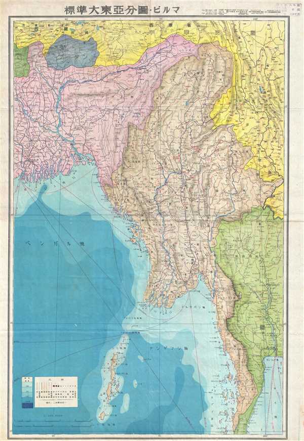
Map of East Asia. Burma. 圖分亞東大準標。ビルマ
1943 (dated) 29.75 x 19.25 in (75.565 x 48.895 cm) 1 : 300000
1943 (dated) 29.75 x 19.25 in (75.565 x 48.895 cm) 1 : 300000
Description
This is a 1943 or Showa 18 Japanese map of Burma / Myanmar. The map depicts the region from India to China and Thailand and from China to the Andaman Sea and the Bay of Bengal. Highly detailed, numerous locations are labeled, along with roads, railways, and rivers. Shipping and air routes are also illustrated. The Andaman and Nicobar Islands are also included. A key in the lower left corner details the symbols used and indicates that ocean depth is illustrated by different shades of blue.
This map is No. 7 of a 20 map series created by the Japanese detailing what the Imperial Japanese referred to as the Greater East Asian Co-Prosperity Sphere, which reflects Japanese imperial ambitions from 1930s until the end of World War II.
This map is No. 7 of a 20 map series created by the Japanese detailing what the Imperial Japanese referred to as the Greater East Asian Co-Prosperity Sphere, which reflects Japanese imperial ambitions from 1930s until the end of World War II.
Condition
Very good. Wear along original fold lines. Blank on verso. Accompanied by original sleeve.