1920 Clason Map of California
California-clason-1920-2$350.00
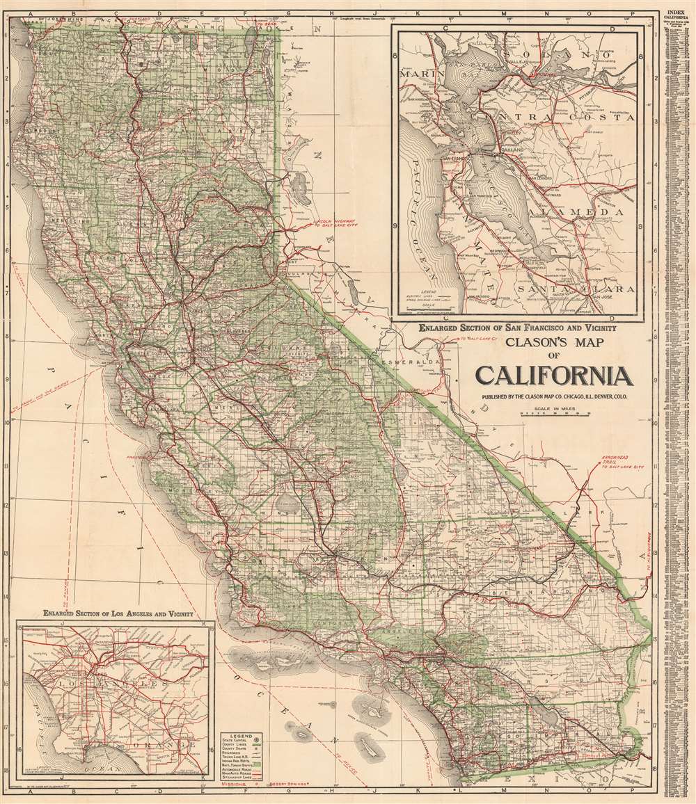

Title
Clason's Map of California.
1920 (undated) 28 x 32 in (71.12 x 81.28 cm) 1 : 1400000
1920 (undated) 28 x 32 in (71.12 x 81.28 cm) 1 : 1400000
Description
This is a large and highly detailed c. 1920 Clason Map Company pocket format map of California. This map depicts the entire state of California with green highlighting to distinguish county borders and national forest lands. Inset submaps in the upper right and lower left quadrants focus on the San Francisco Bay area and the vicinity of Los Angeles, respectively. An index set along the map's left-hand border offers population statistics and a key to various cities throughout the state.
Publication History and Census
Issued by the Clason Map Company of Denver, Colorado and Chicago, Illinois. This map underwent many changes and revisions between 1920 and 1930, all editions of which are undated. The census data on the map correlates to the 1920 Federal Census, which is how the map was dated. While there are some bridges and such on the map that were not constructed as of 1920, it was common to included planed and anticipated bridges on maps to increase their longevity. Nonetheless, with a c. 1920 date, we are confidante that the map was issued sometime between 1920 and the next Federal Census in 1930.Cartographer
George Samuel Clason (November 7, 1874 - 1957) was born in the city of Louisiana, Missouri in 1874. As a young man, Clason studied at the University of Nebraska before joining the United States Army in 1898 to fight in the Spanish American War. After the war, he moved to Denver, Colorado where in 1905 he founded the Clason Map Company, thus starting his lucrative publishing career. Clason initially focused on mining and mineral maps - capitalizing on the Colorado and Nevada mining industry, but quickly transitioned to railroad maps, city maps, and by the 1920s, road maps. As the company expanded, Clason opened a secondary office in Chicago, Illinois - then a rising map publishing center and railroad hub. At least one other satellite office was opened in Los Angeles. Among his many achievements, Clason is credited with producing the first modern road atlas of the United States. In the late 1920s, Clason also published a series of get-rich-quick pamphlets in the form of parables. The most famous of these is The Richest Man in Babylon. This tells the story of Arkad, a citizen of Babylon famed for his great wealth and generosity who shares his wit and wisdom with his fellow Babylonians. In 1949, Clason moved to Napa, California to retire and found a social club for retired gentlemen. More by this mapmaker...
Condition
Good. Some wear along original fold lines. Professionally flattened and backed with archival tissue. Close left margin. Blank on verso.
References
OCLC 176916412.