1921 Rand McNally Railroad Map of California
CaliforniaRailroads-randmcnally-1921$250.00


Title
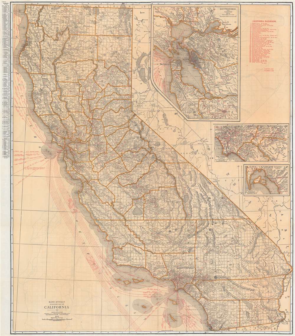
Rand McNally Standard Map of California.
1921 (undated) 37.75 x 33 in (95.885 x 83.82 cm) 1 : 1140480
1921 (undated) 37.75 x 33 in (95.885 x 83.82 cm) 1 : 1140480
Description
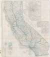
This is a c. 1921 Rand McNally railroad map of California. Black lines trace railroad lines throughout the state, most of which are labeled along their respective route. Red overprinted numbers (1 to 157) correspond with an index in the upper right. Red overprinted dashed and dotted lines highlight operating electric railroad lines. Red dashed lines off the coast represent steamship lines, the majority of which operate out of San Francisco, while most of the remainder depart from Los Angeles. Inset maps of San Francisco, Los Angeles, and San Diego appear in the upper right. An index of California's principal cities appears outside the left border.
Verso Content
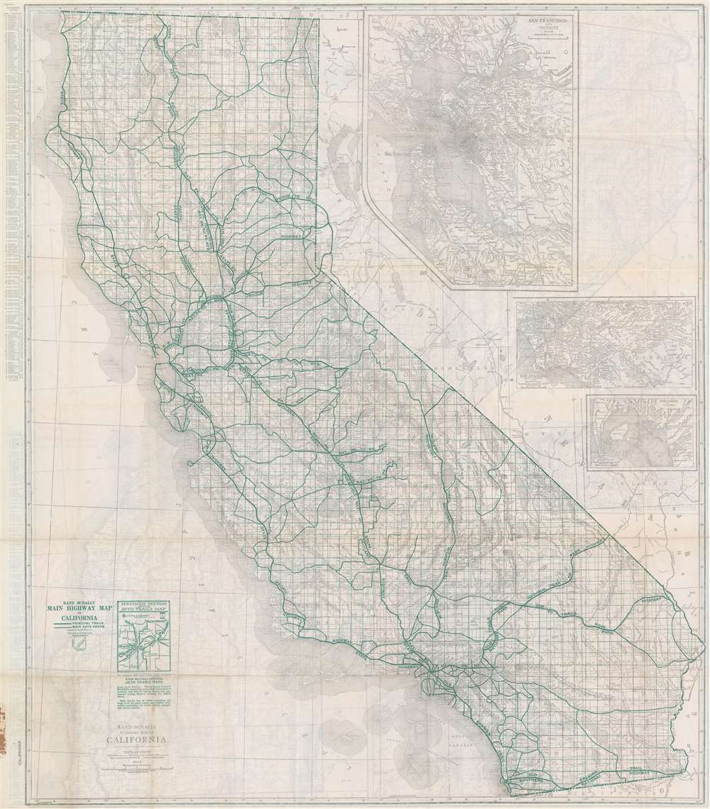
A Rand McNally highway map of California is printed on the verso. Green overprinting highlights the state's many named highways, including the National Park to Park Highway, the Lincoln Highway, the Roosevelt National Highway, and the Pacific Highway. An inset of the San Francisco Bay Area appears in the upper right quadrant.Publication History and Census
This map was created and published by Rand McNally c. 1921. We note a single example of the present map cataloged in OCLC which is part of the collection at the University of California Berkeley. It appears on the private market from time to time.Cartographer
Rand, McNally and Co. (fl. 1856 - present) is an American publisher of maps, atlases and globes. The company was founded in 1856 when William H. Rand, a native of Quincy, Massachusetts, opened a print shop in Chicago. Rand hired the recent Irish immigrant Andrew McNally to assist in the shop giving him a wage of 9 USD per week. The duo landed several important contracts, including the Tribune's (later renamed the Chicago Tribune) printing operation. In 1872, Rand McNally produced its first map, a railroad guide, using a new cost effective printing technique known as wax process engraving. As Chicago developed as a railway hub, the Rand firm, now incorporated as Rand McNally, began producing a wide array of railroad maps and guides. Over time, the firm expanded into atlases, globes, educational material, and general literature. By embracing the wax engraving process, Rand McNally was able to dominate the map and atlas market, pushing more traditional American lithographic publishers like Colton, Johnson, and Mitchell out of business. Eventually Rand McNally opened an annex office in New York City headed by Caleb S. Hammond, whose name is today synonymous with maps and atlases, and who later started his own map company, C. S. Hammond & Co. Both firms remain in business. More by this mapmaker...
Condition
Good. Verso repairs to fold separations. Map of California highways on verso.
References
OCLC 81616229.