1950 Service Geographique Pictorial Tourist Map of Cambodia
CambodgeTouristique-servicegeographique-1950$450.00

Title
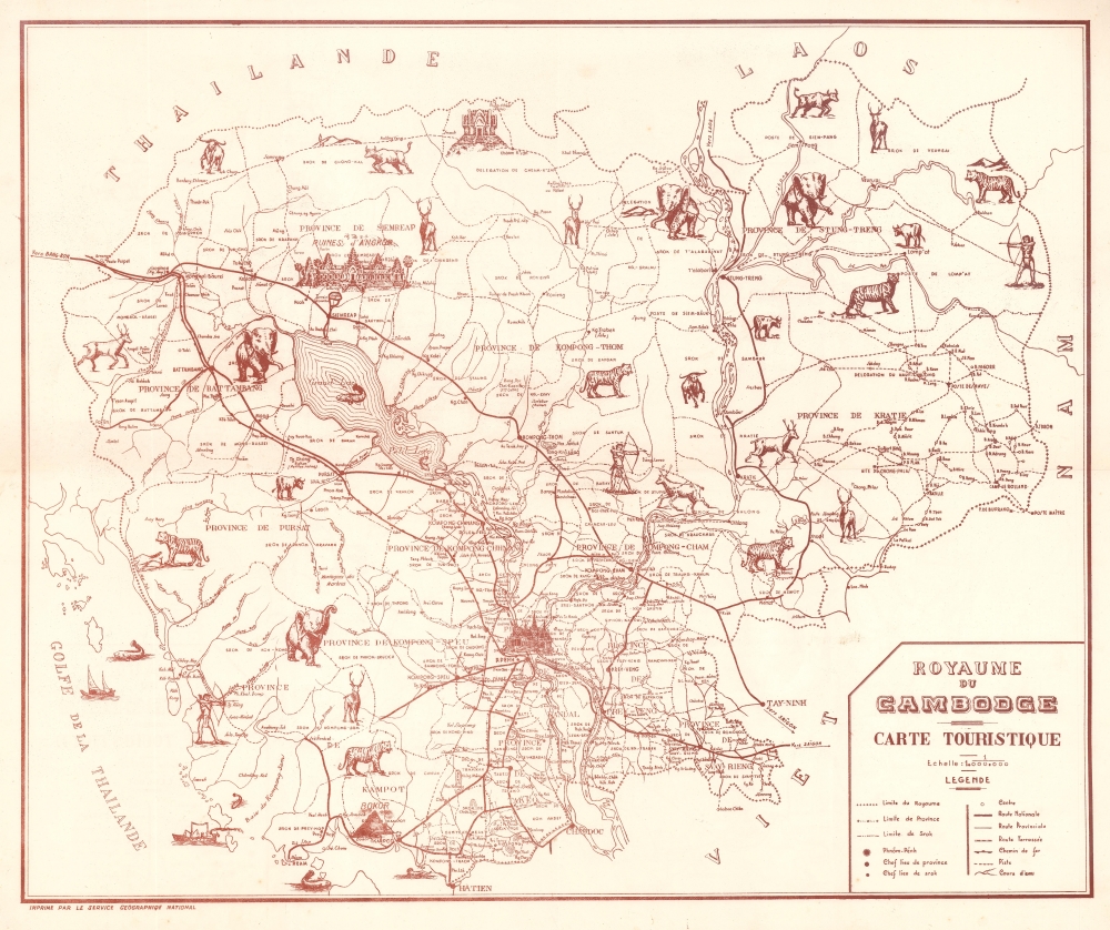
Royaume du Cambodge Carte Touristique.
1950 (undated) 20 x 24 in (50.8 x 60.96 cm) 1 : 1000000
1950 (undated) 20 x 24 in (50.8 x 60.96 cm) 1 : 1000000
Description
This is a c. 1950 Service Géographique National pictorial tourist map of Cambodia, issued during the Sangkum Period. Angkor Wat, labeled here as Ruines d'Angkor, is prominently illustrated in the upper right, near Siem Reap. The ruins of another lesser-known temple complex, Preah Vihear, appear along the northern border. A more modern-looking Cambodian-style temple marks Phnom Penh. Illustrations of regional fauna dot the map, underscoring Cambodia's rich wildlife.
Sangkum Period
This map was issued during the First Kingdom of Cambodia, generally known as the Sangkum Period (1953 - 1970). Under the controversial King Norodom Sihanouk, this era was defined by political unrest but general peace. Sihanouk was an absolutist monarch who spent much of his early reign suppressing both democratic and communist sentiment. His extreme policies ultimately turned catastrophic, leading to the rise of Pol Pot and the Cambodian Genocide in the 1970s.Publication History and Census
This map was created and published by the Service Géographique National c. 1950. This piece is not cataloged in OCLC, and we have not located any other surviving examples.Condition
Very good. Light wear along original fold lines. Some foxing.