1920s Information Bureau Map of Canton or Guangzhou, China
Canton-infobureau-1920$200.00

Title
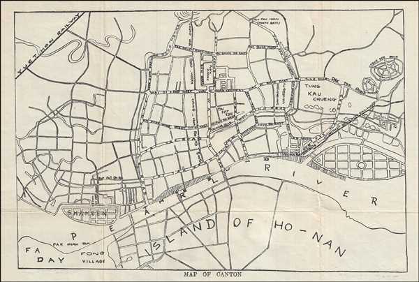
Map of Canton.
1920 (undated) 9 x 13 in (22.86 x 33.02 cm) 1 : 20000
1920 (undated) 9 x 13 in (22.86 x 33.02 cm) 1 : 20000
Description
This is a c.1920s map of Canton or Guangzhou or Kwangchow. It covers part of Guangzhou, the largest city of the Guangdong province located on the Pearl River. This map is highly detailed and notes individual streets, buildings, rivers, parks, railways, as well as topography. Today, Guangzhou and Guangdong Province account for the largest population in China and roughly 12% of China's industrial output. The map was issued as part of the Tourists’ Guide of the Colony of Hong Kong and Vicinity published by The Publicity and Information Bureau in Hong Kong.
Condition
Very good. Minor wear and toning along original fold lines. Minor foxing.