1954 U.S. Air Force Aeronautical Chart or Map of Southern India
CapeComorin-usaf-1954$100.00

Title
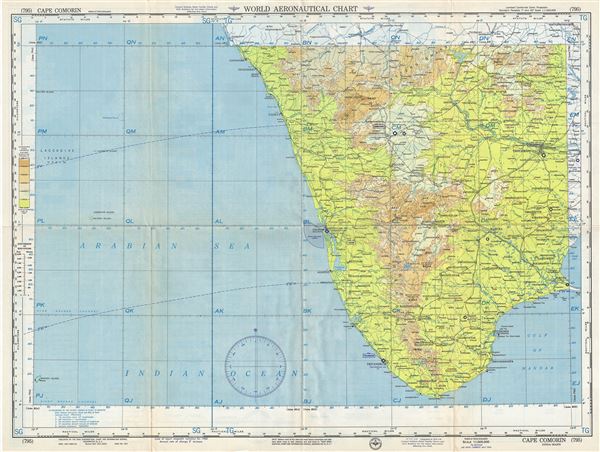
Cape Comorin India-Mahe.
1954 (dated) 22 x 29 in (55.88 x 73.66 cm) 1 : 1000000
1954 (dated) 22 x 29 in (55.88 x 73.66 cm) 1 : 1000000
Description
This is a scarce 1954 U.S. Air Force aeronautical chart or map of the south India. It covers from Thiruvannamalai south to Kanyakumari. Important cities of Madurai, Coimbatore, Cochin, Thiruvananthapuram (Trivandrum), Tiruchirappalli, Madurai, etc. are noted throughout. The map is highly detailed and noted towns, cities, rivers, lakes, capes, bays, roads, railways, and other hydrographical and topographical features essential for the air pilot. Verso of this chart features legends and a world aeronautical chart index. This chart was published by the USAF Aeronautical Chart and Information Service, Washington 25, D.C., and was issued as chart no. 795. First issued in 1947, this is the seventh edition revised to May 1954.
Condition
Very good. Minor wear and toning along original fold lines. Minor spotting.