1955 U.S. Air Force Aeronautical Chart or Map of Southeast Somalia
CapeElCheil-usaf-1955$100.00

Title
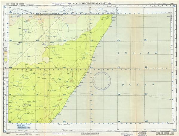
Cape El Cheil British Somaliland-Ethiopia-Italian Somaliland.
1955 (dated) 22 x 29 in (55.88 x 73.66 cm) 1 : 1000000
1955 (dated) 22 x 29 in (55.88 x 73.66 cm) 1 : 1000000
Description
This is a scarce 1955 U.S. Air Force aeronautical chart or map of southeastern Somalia. It covers from El Uarot north past Obbia or Hobya port city to Negro Bay and inland as far as Galadi. The chart notes towns, roads, cities, rivers, topography and other data essential to the air pilot. Verso features legends and a world aeronautical chart index. This chart was published by the Aeronautical Chart Service, Washington 25 D.C., and issued as chart no. 808. First issued in 1947, this is the second edition revised to Jan 1955.
Condition
Very good. Minor wear and toning along original fold lines. Minor spotting.