1933 Sewah Studios Pictorial Map of Ohio (The Chicago World's Fair)
CartographOhio-sewah-1933-2$275.00
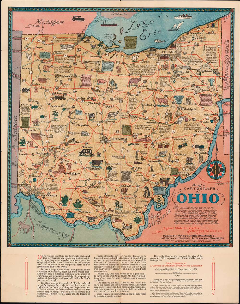

Title
Being a Cartograph of Ohio.
1933 (dated) 23.5 x 19 in (59.69 x 48.26 cm) 1 : 884000
1933 (dated) 23.5 x 19 in (59.69 x 48.26 cm) 1 : 884000
Description
This is a beautiful 1933 Sewah Studios pictorial map of Ohio published by the Ohio Commission to A Century of Progress International Exposition at the Columbian Exposition or The Chicago World’s Fair. Numerous illustrations populate the state, referencing history, topography, fun facts about Ohio, points of interest, and animals. Some of these include ‘The only Y bridge in the United States’, Natural Bridge, ‘Throughout Ohio are many interesting caves and caverns. In this locality are some of the most extensive’, ‘birthplace of Senator Grant’, etc.
Included Display Recommendations
The bottom half of the map includes information about the state and suggestions on ways to display the map, including ‘This map can be most interestingly made into a decorative wall piece, a wastebasket, a tea tray or lamp shade…’. This map promotes Ohio as 'The oldest state west of the thirteen original colonies; now the fourth state in the Union in population, third in manufacture; sixth in minerals mined; and among the foremost in agriculture’ and ‘A good state to visit, better yet to live in.'Publication History
Created by Sewah Studios, Marietta and published by the Ohio Commission to A Century of Progress International Exposition in 1933. This map is well represented in institutional collections.Condition
Very good. Minor wear along original fold lines. Verso repairs to fold separations. Minor spotting.
References
Rumsey 8063.000. OCLC 58411478.