1900 Manuscript Map of Ceylon (Sri Lanka)
CeylonManuscript-unknown-1925$500.00

Title
Ceylon.
1925 (undated) 7 x 5 in (17.78 x 12.7 cm) 1 : 3801600
1925 (undated) 7 x 5 in (17.78 x 12.7 cm) 1 : 3801600
Description
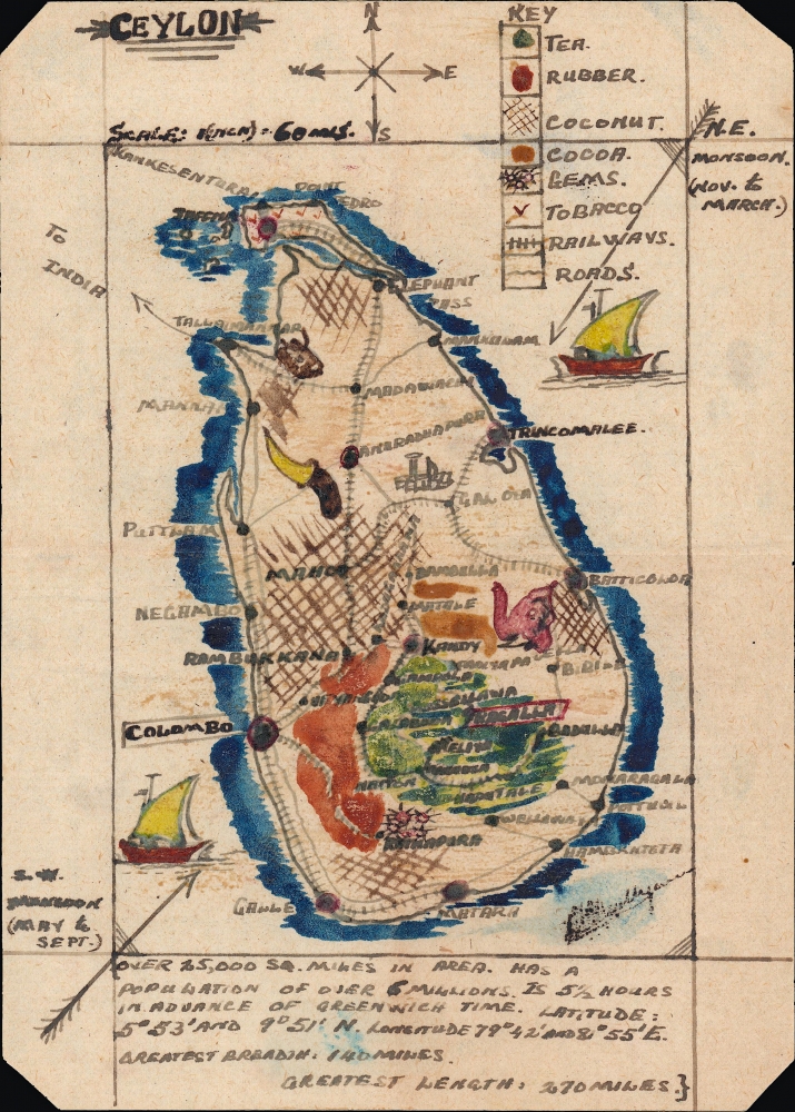
A charming c. 1900 small-format map of Ceylon (Sri Lanka), produced by an unknown cartographer. Despite its size, the map provides detail on the island's climate, topography, economy, infrastructure, demographics, and more.
A Closer Look
The island is displayed in its entirety, with basic data about its size and population at bottom. Arrows indicate the direction and months of the seasonal monsoons. On land, symbols corresponding to the key at top highlight local industries, roads, railways. The arrow labelled 'To India' likely represents the Pamban Bridge, a rail link opened in 1914. The map is adorned with illustrations of ships, elephants, mountains, and more.Publication History and Census
Although signed towards bottom-right, the cartographer's signature is now unfortunately illegible. The map is undated, but likely hails from the mid-late 1920s, as the railway network's Main Line appears to reach Badulla, a connection completed in 1924.Condition
Very good.