This item has been sold, but you can get on the Waitlist to be notified if another example becomes available, or purchase a digital scan.
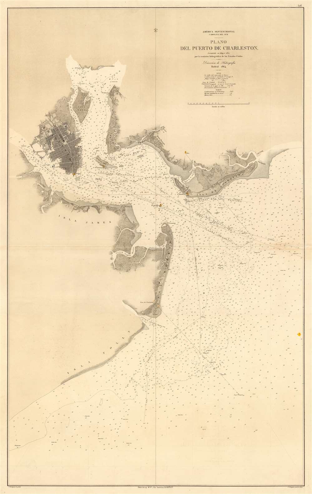
1864 Spanish Nautical Map of Charleston Harbor, South Carolina
CharlestonHarbor-direccionhidrografia-1864
Title
1864 (dated) 38.25 x 24.25 in (97.155 x 61.595 cm) 1 : 35000
Description
Spain and the Confederacy
After a period of decline in the early 19th century, Spain entered a period of relative political stability and sustained economic growth leading to a strengthening of its naval and military forces. Indeed, under Leopoldo O'Donnell, Spain's navy grew so fast that by 1860, it was the 4th largest naval power in the world. Spain was well positioned to reassert its colonial power, especially with the United States distracted by the American Civil War.When the American Civil War broke out in 1862, Spain and the Confederacy were natural allies. Moreover, like the Confederacy, Spain was he only European country that continued to support slavery in its Puerto Rician and Cuban plantations. Nonetheless, Spain refused to officially sanction the Confederacy, instead signing a declaration of neutrality in 1861.
Nonetheless, Spain had its eye on the Confederacy. While the government sanctioned no official aid to the Confederacy, enterprising Spanish merchants and ship owners were not discouraged from running the Union naval blockades to supply the south. This chart was part of a collection of maps issued in 1864 detailing Confederate ports and coastlines, doubtless issued due to increased Spanish interest in trade with the South.
Publication History and Census
The chart is derived from U.S. Coast survey work completed between 1849 and 1852, but has here been resized and fully re-engraved exhibiting a superior level of workmanship. The map was engraved by Pedro Hortigosa (1811-1870) and the lettering by F. Bregante. The appears to have been only one edition, suggesting that the subsequent defeat of the Confederacy in 1865, and the destabilization of Spain in the same year, eliminated the demand for updates.This chart is scarce and does not appear in the OCLC. There are only a couple of records of it being offered on the private market.
CartographerS
The Direccion Hidrografía (1787 - 1927), also known as the Deposito Hydrografico and the Direction de Hidrografía, was the Spanish equivalent of the British Admiralty or the U.S. Coast Survey. This organization, founded in 1787, was commissioned to collect and produce accurate nautical charts of all waters frequented by Spanish vessels. In essence, it replaced the Casa de la Contratación de las Indias (House of Trade of the Indies), which closed its doors in 1790. Like most such organizations, the Direccion Hidrografía marked a new age in cartography. Rather than simply collect charts created by navigators, explorers, and merchants, the Direccion Hidrografía worked closely with naval and military personnel to mount cartographic and hydrographic expeditions in pursuit of the most accurate hydrographical, astronomical, and geodetic measurements. The Direccion Hidrografía created a massive library of nautical charts that, though not nearly as common as similar nautical charts by the U.S. Coast Survey and British Admiralty, are highly desirable for the beauty of their manufacture as well as their accuracy and detail. The office was originally located on Calle Ballesta, but relocated to 36 Alcala, both in Madrid. After 1908 the Dirección was subsumed into other governmental agencies. In 1927 the Direccion was absorbed into the Institute and Observatory of San Fernando, located in Cadiz. The library of original maps, charts, and journals was transferred to the Naval Museum of Madrid - where it resides to this day. More by this mapmaker...
Pedro Hortigosa (1811 - 1870) was a Spanish artist, professor, and engraver active in Spain during the middle part of the 19th century. Hortigosa was born in Segovia, Spain. He initially studied painting under the Spanish neoclassical painter Vicente Lopez Portaña (1772 - 1850). He also attended the Real Academia de Bellas Artes de San Fernando (Royal Academy of Fine Arts of San Fernando). He was recognized with awards in 1832, and in 1855, became professor at the Escuela de Bellas Artes de Sevilla (Good of Fine Arts of Seville). There he developed an interest in printmaking and possibly traveled to France to study the latest techniques. He seems to have worked on a commission basis for the Direccion de Hidrografia, engraving nautical charts as early as the 1840s and as late as the 1870s. He died in Madrid. Learn More...

