
This item below is out of stock, but another example (left) is available. To view the available item, click "Details."
Details
1954 Direction Generale du Tourisme Map of French Chateaux (Castles)
$250.00
1954 Direction Generale du Tourisme Map of French Chateaux (Castles)
Chateaux-directiontourisme-1954$125.00

Title
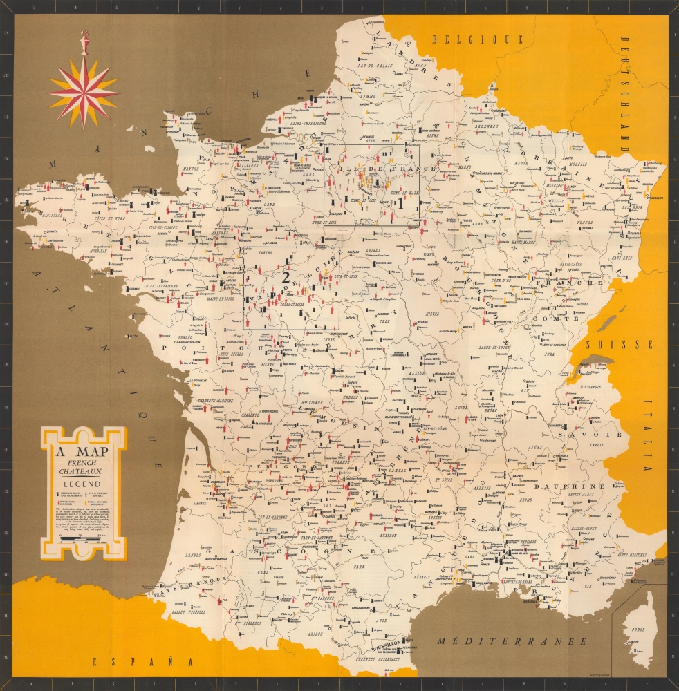
A map : French Châteaux.
1954 (undated) 24.5 x 24 in (62.23 x 60.96 cm) 1 : 1400000
1954 (undated) 24.5 x 24 in (62.23 x 60.96 cm) 1 : 1400000
Description
A memorable c. 1954 tourist map of France, published by the government's Direction Générale du Tourisme, highlighting the location of chateaux, castles, ruins, and other historic buildings. Intended for English-speaking tourists, it reflects the French efforts to boost tourism, today a major contributor to the economy.
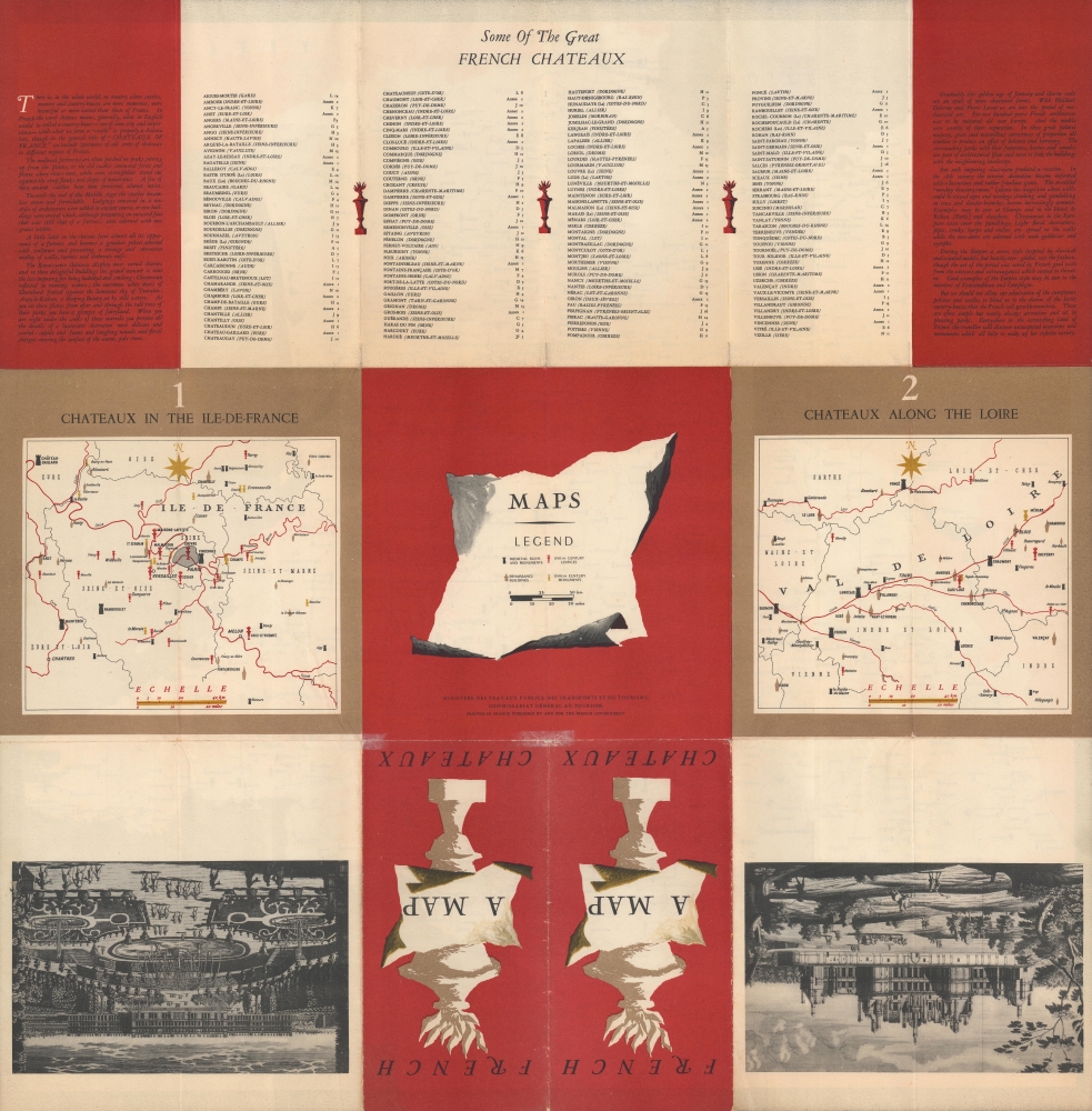
Two boxes on the recto highlight the Ile-de-France and the Loire River Valley, which offer a dense concentration of well-preserved and imposing chateaux. These two regions detailed via inset maps on the verso.
The verso also includes explanatory text, for example regarding the history and definition of chateaux. Different periods and styles of architecture are discussed, some of which were opulent but never gaudy, having been 'saved by French good taste from the excesses and extravagances which seemed to threaten.'
This map was published in the early phase of France's postwar economic recovery known as the 'Trente Glorieuses.' Although most economic growth at that time was due to industrialization, increasing wealth across Europe and beyond, combined with greater ease of international travel, boosted domestic and international tourism.
A Closer Look
The European départements of France, including Corsica at bottom-right, are illustrated. A legend explains the symbols used for various monuments, ruins, and other buildings, while admitting that these distinctions can be very difficult given the accretion of structures at a single site over centuries. A grid along the border corresponds to a verso index, allowing for the quick location sites.Two boxes on the recto highlight the Ile-de-France and the Loire River Valley, which offer a dense concentration of well-preserved and imposing chateaux. These two regions detailed via inset maps on the verso.
The verso also includes explanatory text, for example regarding the history and definition of chateaux. Different periods and styles of architecture are discussed, some of which were opulent but never gaudy, having been 'saved by French good taste from the excesses and extravagances which seemed to threaten.'
This map was published in the early phase of France's postwar economic recovery known as the 'Trente Glorieuses.' Although most economic growth at that time was due to industrialization, increasing wealth across Europe and beyond, combined with greater ease of international travel, boosted domestic and international tourism.
Publication History and Census
This map was prepared by the Direction Générale du Tourisme, a French government office, in or around 1954. The OCLC lists it among the holdings of thirteen institutions.Cartographer
Direction générale du tourisme (1927 - 1965), part of the Commissariat général au tourisme, was an office within the Ministère des travaux publics, des transports et du tourisme tasked with promoting France to potential foreign tourists, an important part of France's postwar economic recovery. France's tourist promotion bureaucracy has undergone several reorganizations, eventually falling under the Ministère du Commerce, de l'Artisanat et du Tourisme, now simply named the Ministère du Commerce. More by this mapmaker...
Condition
Very good. Wear along fold lines, with fold intersections reinforced on the verso.
References
OCLC 223548091, 1346185104.