1878 Rand McNally Railroad Map of U.S. and the Chicago, Burlington, and Quincy R.R.
ChicagoBurlingtonRR-randmcnally-1878$575.00

Title
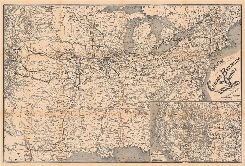
Map of the Chicago Burlington and Quincy Railroad and its Connections.
1878 (dated) 20 x 30 in (50.8 x 76.2 cm) 1 : 4055040
1878 (dated) 20 x 30 in (50.8 x 76.2 cm) 1 : 4055040
Description
This is an 1878 Rand McNally railroad map of the United States featuring the Chicago, Burlington, and Quincy Railroad. The Chicago, Burlington, and Quincy (CBQ) is highlighted in Illinois, Iowa, and Missouri. Thinner lines trace connecting railroads, including the 'Burlington and Missouri River Railroad', and the 'Burlington, Cedar Rapids, and Northern Railroad'. Other important connections include the Union Pacific, Kansas Pacific, 'Denver and Rio Grande', and the 'Atchison, Topeka, and Santa Fe' railroads. An inset map in the lower right depicts the western United States and its own expanding railroad network.
The Chicago, Burlington, and Quincy Railroad
The Chicago, Burlington, and Quincy Railroad, commonly known as the Burlington Route, was a railroad that operated in the Midwestern United States. The Burlington Route into existence on February 14, 1855, out of a reorganization of the Chicago and Southwestern Railroad. The railroad continued expanding, acquiring trackage, equipment, locomotives, and cars. The Burlington Route entered stock exchange in 1862 and has, up to the present, paid dividends and never run into debt or defaulted on a loan, making it the only Class I U.S. railroad to accomplish this feat. Burlington was purchased by the Great Northern Railway and the Northern Pacific Railway over the course of a few years, and by 1900 the two railroads owned nearly all of Burlington's stock. The three railroads operated independently until March 2, 1970, when the Great Northern, Northern Pacific, and the Spokane, Portland, and Seattle Railway merged to form the Burlington Northern. The Burlington Northern merged with the Santa Fe Railroad in 1996 to form the Burlington Northern and Santa Fe Railway.Publication History and Census
This map was designed by Emil Heubach, engraved by Frank Roehb, published by Rand McNally, and distributed by the Chicago, Burlington, and Quincy Railroad in 1878. We note two cataloged examples, at Yale University and the University of Washington.CartographerS
Rand, McNally and Co. (fl. 1856 - present) is an American publisher of maps, atlases and globes. The company was founded in 1856 when William H. Rand, a native of Quincy, Massachusetts, opened a print shop in Chicago. Rand hired the recent Irish immigrant Andrew McNally to assist in the shop giving him a wage of 9 USD per week. The duo landed several important contracts, including the Tribune's (later renamed the Chicago Tribune) printing operation. In 1872, Rand McNally produced its first map, a railroad guide, using a new cost effective printing technique known as wax process engraving. As Chicago developed as a railway hub, the Rand firm, now incorporated as Rand McNally, began producing a wide array of railroad maps and guides. Over time, the firm expanded into atlases, globes, educational material, and general literature. By embracing the wax engraving process, Rand McNally was able to dominate the map and atlas market, pushing more traditional American lithographic publishers like Colton, Johnson, and Mitchell out of business. Eventually Rand McNally opened an annex office in New York City headed by Caleb S. Hammond, whose name is today synonymous with maps and atlases, and who later started his own map company, C. S. Hammond & Co. Both firms remain in business. More by this mapmaker...
Emil Heubach (September 1837 - 191x) was a German American mapmaker / draughtsman. Born in Germany, Heubach immigrated to the United States in 1866. By 1870 Heubach was living in Chicago working as a draughtsman. He worked as a mapmaker in Chicago until at least 1910. He married his wife Emma in 1867 with whom he had at least five children. Learn More...
Condition
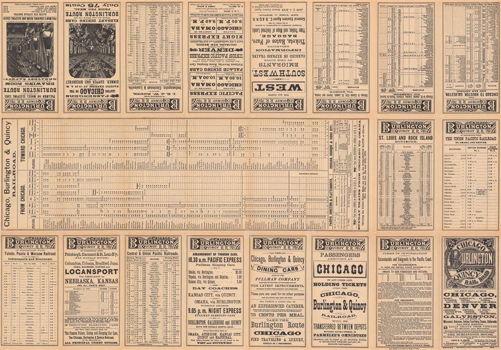
Very good. Light wear along original fold lines. Verso repairs to fold separations. Very small areas of loss at some fold intersections. Timetables and other information printed on verso.
References
OCLC 953520237, 61448771.