1867 Dennys 'Treaty Ports of China and Japan' w/Hong Kong and other Maps
ChinaJapanHongKong-dennys-1867$6,500.00
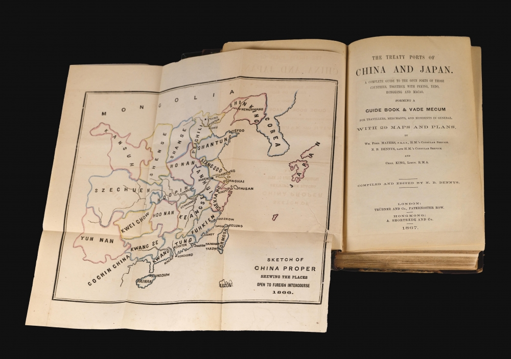


Title
The Treaty Ports of China and Japan. A Complete guide to the Open Ports of Those Countries, Together with Peking, Yedo, Hong Kong and Macao.
1867 (dated) 9 x 6 in (22.86 x 15.24 cm)
1867 (dated) 9 x 6 in (22.86 x 15.24 cm)
Description
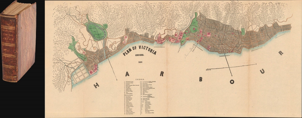
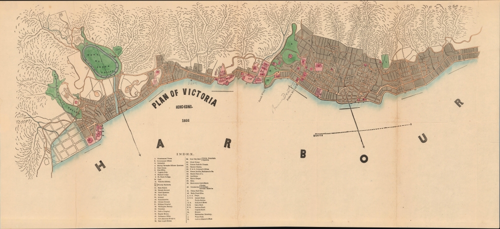
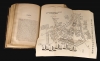
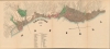
This is the 1867 first edition of Nicholas Belfield Dennys (c. 1813 - 1899) detailed guide to the Treaty Ports of China and Japan, including a dramatic large map of Victoria, Hong Kong. Intended both for new residents and travelers, it is the first commercially distributed handbook to the post-Opium War Treaty Ports. There are an impressive 29 excellent maps, most fold out, all engraved in Hong Kong. Like the maps, the book was typeset in China, where place names and other content could be set in both English and in Chinese.
A Closer Look
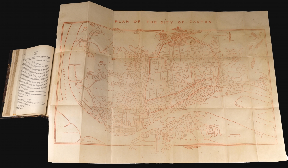
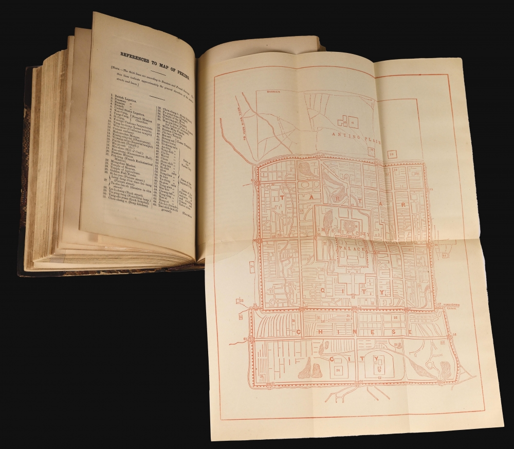
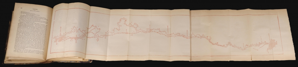
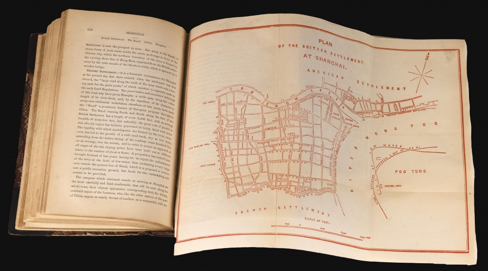
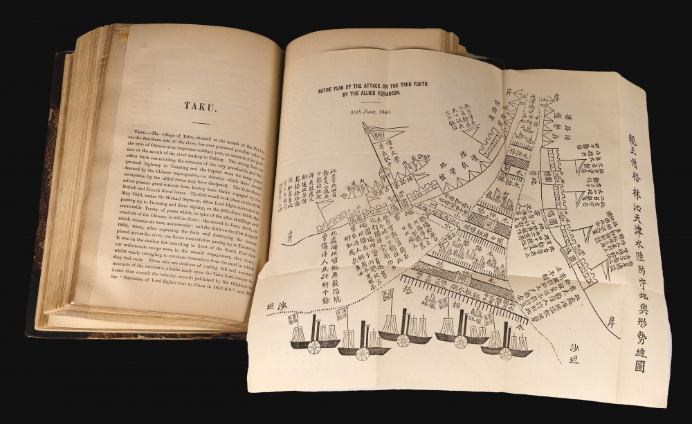
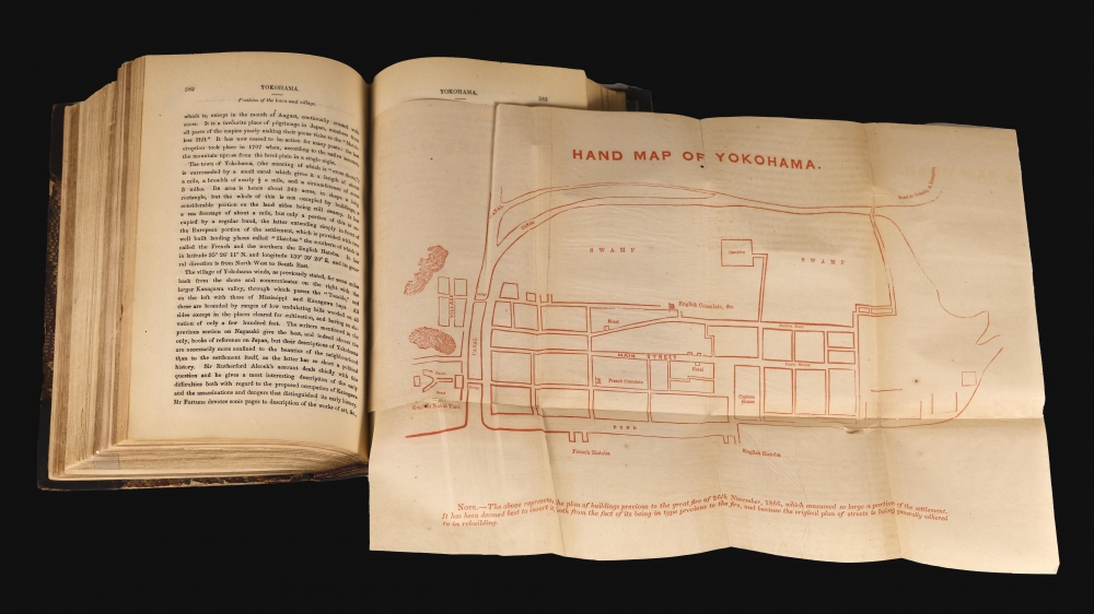
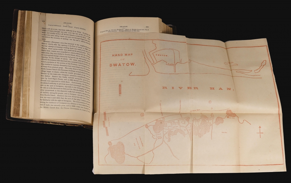
The book features some 668 pages plus appendices. It introduces the treaty ports, describing each in detail, highlighting aspects of commerce, government, and geography, as well as history, architecture, social structure, civic support, and entertainment available to the foreigner. It also includes general overviews of China and Japan, describing language, culture, currency, and more. Over twenty cities in China and Japan are detailed, most with one or more representative maps: Hong Kong, Macau, Beijing, Canton (Guangzhou), Shanghai, Shantou, Xiamen, Fuzhou, Taiwan, Ningbo, Yangtze River ports, Tianjin, Nagasaki, Edo, Yokohama, and Hakodate, among others. The work ends with an interesting Appendix C, a 26-page 'Catalogue of books on China (other than philological) published on China and Japan in the English language'.Treaty Ports of China
Treaty ports in China were a result of various 'unequal' treaties signed between Chinese Qing dynasty and foreign powers during the 19th and early 20th centuries. These agreements, often imposed on China following military defeats, allowed Western powers and Japan to establish zones within certain Chinese cities where they held legal jurisdiction and economic control. The most famous of these were Shanghai, Hong Kong, and Canton (Guangzhou). They became hubs of international trade and cultural exchange, but also symbols of foreign dominance and exploitation. The presence of foreign powers in these ports greatly influenced the social, economic, and political landscape of China, contributing to internal tensions and the eventual decline of the Qing. The dissolution of these treaty ports occurred gradually, culminating (mostly) in their full reintegration into Chinese sovereignty after World War II (1939 - 1945).Publication History and Census
This book was written in 1866 by Nicholas Belfield Dennys, with assistance from William F. Mayers (1831 - 1878) and Charles King (1844 - 1933). The maps were engraved in China, and the book itself typeset in Hong Kong. It was published in London by Trübner and Company, and in Hong Kong by A. Shortrede and Company. In OCLC, we see examples of this first edition at the Bibliothèque nationale de France and the British Library. We note an additional example at the National Library of Australia, Harvard, the Biblioteca Pública de Macau, and a few other institutions. It appears occasionally on the market, often with some or all maps replaced in facsimile.Cartographer
Nicholas Belfield Dennys (January 25, 1839 - December 5, 1900) was a British journalist, civil servant, and sinologist based in China and Singapore in the second half of the 19th century. Dennys joined the British navy in 1855. In that year, he saw action at the Crimean War (1853 - 1856) Battle of Suomenlinna. In 1863 he subsequently resigned from the Navy and joined the British Consular Service in China. He showed a remarkable aptitude for languages and quickly learnt Chinese, after which he resigned from the consular service to take over the newspaper China Mail, a position he maintained until 1976. At the same time, he was the curator of the Hong Kong Museum and Library. In 1877, he relocated to Singapore, where he became assistant-protector of Chinese at Singapore and Justice of Peace for the Straits Settlements. There too, he became a museum curator, taking over the Raffle Museum. In 1889, he received a post as magistrate in the Federated Malay States, but, in ill health, almost immediately resigned. He is considered a pioneer Sinologist, his most influential works being his 1867 The Treaty Ports of China and his 1876 Folklore of China. More by this mapmaker...
Condition
Very good. All 29 maps present. Some of the maps, including Hong Kong and Canton, laid on archival tissue. Others, more minor maps, exhibit minor verso reinforcements and/or splits along folds (but all content present). Original quarter-leather binding tight with guilt on spine. Hong Kong and Shanghai maps loose from binding.
References
OCLC 457653562.