This item has been sold, but you can get on the Waitlist to be notified if another example becomes available, or purchase a digital scan.
1966 Sino Map Publishing Chinese Schematic Railroad Map of China
ChinaRailroad-sinomap-1966$200.00

Title
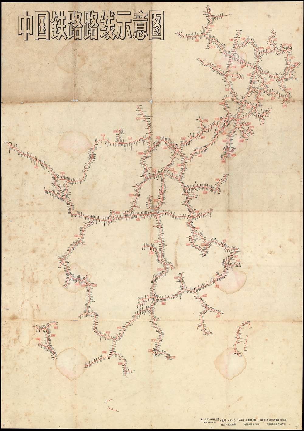
中国铁路路线示意图 / Chinese Railroad Schematic Route Map.
1966 (dated) 28.5 x 20 in (72.39 x 50.8 cm)
1966 (dated) 28.5 x 20 in (72.39 x 50.8 cm)
Description
An interesting 1966 Schematic map of the railroad systems of China, including Taiwan, issued by China Cartographic Publishing House (中国地图出版社). This starkly modern map exhibits no geographical content, rather, in the spirit of London Underground maps of the 1920s and 1930s, focuses exclusively on the railroad network and connections.
Railroads in China
The first railway to be built in China was a 600-metre narrow gauge demonstration line that a British merchant assembled in Beijing in 1864 in hopes of securing a national contract from the Qing government. The Emperor was unimpressed and ordered the railroad disassembled. The next effort, again by the British, was built in 1876 without Qing approval between Shanghai and Woosung (Baohan, Shanghai). Following the First Sino-Japanese War (1894 - 1895), the Qing began to recognize the advantage of railroads, and modern technology in general, and began granting construction contracts. Railroad construction continued throughout the remaining years of the Qing Dynasty and during the Republic of China Period (1912 - 1949). During the Second Sino-Japanese War (1839 - 1945), Japanese companies also built numerous railroads in the occupied territories. After the establishment of the People's Republic of China in 1949, the new government under Mao Zedong invested heavily in the railway network. From the 1950s to the 1970s, railroad lines throughout the country were dramatically expanded. Some lines, particularly in the mountainous regions of southern and western China, were not completed until recently.Publication History and Census
This map was published in multiple editions from at least the 1960s to about the 1970s. Examples are rare outside of China and we have identified no institutional holdings. The Hangzhou Library may own a much updated 1974 edition.Cartographer
China Cartographic Publishing House (中国地图出版社; 1954 - present) is the only national-level publisher of maps in the People's Republic of China and is by far the largest publisher of maps in China. The firm was formed with the consolidation of the state-run Xinhua Map Agency and 15 other private press agencies, among them some of the earliest known modern Chinese map publishers dating to about 1900. Its official English name has been changed to Sino Map Press. More by this mapmaker...
Condition
Good. Soiling. Dampstaining. General China map on verso.