This item has been sold, but you can get on the Waitlist to be notified if another example becomes available, or purchase a digital scan.
1928 Mendenhall Map of Cincinnati
Cincinnati-mendenhall-1928$125.00


Title
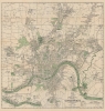
Mendenhall's standard guide map of Cincinnati : accompanied by new ready reference street index.
1928 (dated) 31 x 30.25 in (78.74 x 76.835 cm) 1 : 30170
1928 (dated) 31 x 30.25 in (78.74 x 76.835 cm) 1 : 30170
Description
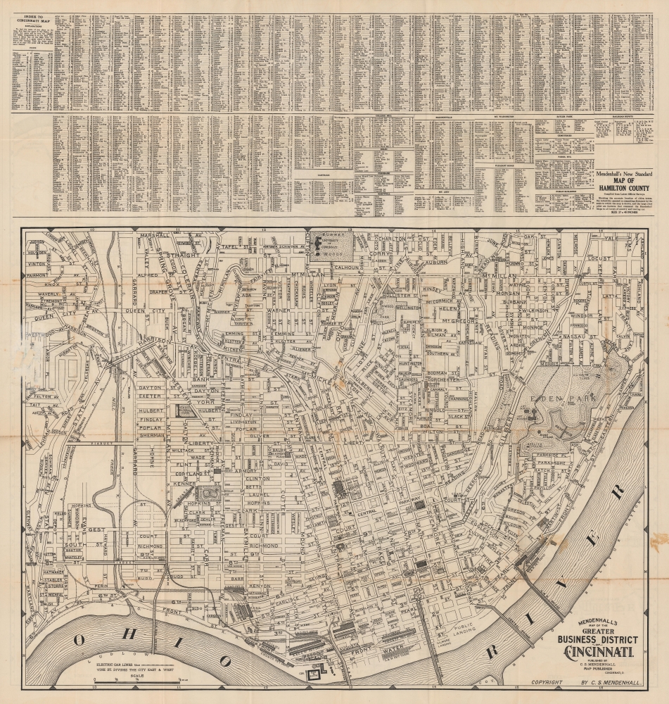
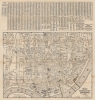
A large-scale folding map of Cincinnati and its suburbs produced in 1928 by C.S. Mendenhall. It depicts the city as it grew considerably, annexing nearby towns and filling in surrounding countryside.
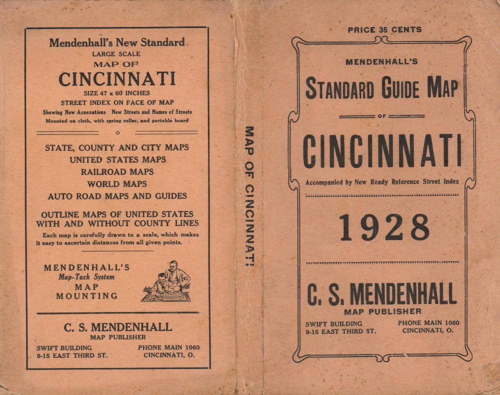
On the water, canals, locks, dams, and dikes are noted, while state, city, ward, and section borders are marked. An inset at bottom-left highlights newly annexed territory in the far western part of the city near Anderson Ferry (where a passenger and vehicle ferry by that name still operates today). An alphanumeric grid in the margins corresponds to an index on the verso. The verso also includes a map focused on the greater business district or downtown Cincinnati
Streetcar lines were developed in the closing decades of the 19th century, and in the early 20th century Cincinnati began building a subway system, noted here as the 'rapid transit loop,' using the defunct Miami and Erie Canal as a basis. Though the line was partially constructed, including four stations, financial setbacks caused by World War I, Prohibition, and the Great Depression meant it was never completed or opened to the public. The project was indefinitely postponed in 1928, the year of this map's publication, and it remains the largest abandoned subway tunnel system in the U.S.
A Closer Look
The main map on the recto displays the urban growth of Cincinnati, reaching far beyond its original core along the banks of the Ohio River. Green is used to indicate rivers as well as public spaces such as government buildings, parks, and cemeteries (several German cemeteries are divided by denomination, reflecting the large number of German-speaking immigrants who came to the city in the 19th century). Green lines along streets trace electric railway or streetcar lines, while railroad tracks are denoted with black lines.On the water, canals, locks, dams, and dikes are noted, while state, city, ward, and section borders are marked. An inset at bottom-left highlights newly annexed territory in the far western part of the city near Anderson Ferry (where a passenger and vehicle ferry by that name still operates today). An alphanumeric grid in the margins corresponds to an index on the verso. The verso also includes a map focused on the greater business district or downtown Cincinnati
Historical Context
Cincinnati was founded in the 1790s opposite the confluence of the Ohio and Licking Rivers. The city's early development was aided by the adoption of steamboats, and later by canals and railroads (the density of rail lines, especially on the city's west side, is apparent here). In 1880, in a highly unusual move, the city financed a railroad to Chattanooga, Tennessee (now part of the Cincinnati, New Orleans and Texas Pacific Railway). Cincinnati's location on the Ohio River made it a good transit point for agricultural resources produced nearby (including Kentucky and Indiana), and the city attracted Irish and German immigrants in large numbers in the mid-19th century. Between 1850 and 1900, the city's population nearly tripled to over 300,000, and it continued to grow at a steady clip in the first decades of the 20th century.Streetcar lines were developed in the closing decades of the 19th century, and in the early 20th century Cincinnati began building a subway system, noted here as the 'rapid transit loop,' using the defunct Miami and Erie Canal as a basis. Though the line was partially constructed, including four stations, financial setbacks caused by World War I, Prohibition, and the Great Depression meant it was never completed or opened to the public. The project was indefinitely postponed in 1928, the year of this map's publication, and it remains the largest abandoned subway tunnel system in the U.S.
Publication History and Census
This map was published by C.S. Mendenhall in 1928. Although there are several other editions of maps with this title listed in the OCLC, there are none dated to 1928.Cartographer
C.S. Mendenhall (fl. c. 1880 - 1930) was a Cincinnati-based map publisher at the turn of the 20th century that mostly produced maps of his home city and nearby areas. Beginning in the 1860s, one E. Mendenhall, presumably the father of C.S., began to publish maps of Cincinnati, with the pace of publications picking up significantly in the 1880s under the name C.S. Mendenhall. He is perhaps best remembered for the large, early road maps that he published of eastern and Midwestern states. More by this mapmaker...
Condition
Very good. Wear along original fold lines. Verso repairs at a few fold intersections. Two small areas of infill where previously attached to binder.