1949 Crocker First National Bank Pictorial Map of San Francisco, California
CityGoldenGate-crockerfirstnational-1949$225.00

Title
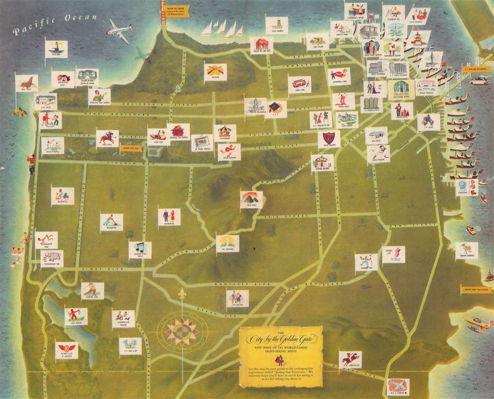
The City by the Golden Gate and some of its World-Famed Sight-Seeing Spots.
1949 (undated) 16 x 19.75 in (40.64 x 50.165 cm)
1949 (undated) 16 x 19.75 in (40.64 x 50.165 cm)
Description
Published one hundred years after the beginning of the California Gold Rush, this is a 1949 Crocker First National Bank pictorial map of San Francisco, California. 'Flags' with illustrations mark sites of interest. Among the noted sites are the Palace of Fine Arts, Fisherman's Wharf, Twin Peaks, and Telegraph Hill. Golden flags identify important landmarks, including the Golden Gate Bridge, Golden Gate Park, the San Francisco-Oakland Bay Bridge, and the Hunter's Point Naval Drydock.
Publication History and Census
This map was created for and published by Crocker First National Bank. We note two examples cataloged in OCLC: California Historical Society and the University of California Berkeley. Scarce on the private market.Condition
Very good. Mounted on heavy linen.
References
OCLC 53475462.