This item has been sold, but you can get on the Waitlist to be notified if another example becomes available, or purchase a digital scan.
1842 Wyld Large-Scale Map of the CIty of London, England
CityofLondon-wyld-1842$2,000.00


Title
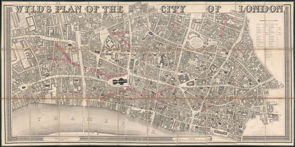
Wyld's Plan of the City of London.
1842 (dated) 26 x 50 in (66.04 x 127 cm) 1 : 2535
1842 (dated) 26 x 50 in (66.04 x 127 cm) 1 : 2535
Description
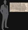
An exceptionally striking large scale 1842 map of the 'City of London' issued by James Wyld to illustrate new and proposed streets. Wyld presents a highly detailed focus, with coverage extending from roughly St. Clement Danes Church to Minories, and from Charter House Square to the Thames. Notably, it names and numbers individual property lots. The map is surmounted with bold titling in large decoratively engraved letters.
Upgrading London
The map is based upon the relevant sections of the magnificent Richard Horwood Plan, issued by subscription on 32 large sheets between 1792 and 1799. It is, however, by no means a slavish copy. Instead, Wyld has meticulously updated the cartography throughout to reflect the situation in 1842. The choice of Horwood's plan as a base is significant, as it was the first to attempt to show every individual property. The present map was intended to illustrate proposed street improvements and, more specifically, the properties they would effect. The improvement areas are shaded in pink. Some of the improvements were never completed, but others, such as the expansion of Cannon Street, Queen Victoria Street, and the clearing of a large area to the north of St. Paul's Cathedral, were finished.Publication History and Census
Wyld first issued this map in 1840. The present example has been updated and revised to reflect proposed street improvement as of 1842. The map is rare. We note examples at Yale and at the British Library.Cartographer
Wyld (1823 - 1893) was a British publishing firm active throughout the 19th century. It was operated by James Wyld I (1790 - 1836) and his son James Wyld II (November 20, 1812 - 1887) were the principles of an English mapmaking dynasty active in London during much of the 19th century. The elder Wyld was a map publisher under William Faden (1749 - 1836) and did considerable work on the Ordinance Survey. On Faden's retirement in 1823, Wyld took over Faden's workshop, acquiring many of his plates. Wyld's work can often be distinguished from his son's maps through his imprint, which he signed as 'Successor to Faden'. Following in his father's footsteps, the younger Wyld joined the Royal Geographical Society in 1830 at the tender age of 18. When his father died in 1836, James Wyld II was prepared to fully take over and expand his father's considerable cartographic enterprise. Like his father and Faden, Wyld II held the title of official Geographer to the Crown, in this case, Queen Victoria. In 1852, he moved operations from William Faden's old office at Charing Cross East (1837 - 1852) to a new, larger space at 475 Strand. Wyld II also chose to remove Faden's name from all of his updated map plates. Wyld II continued to update and republish both his father's work and the work of William Faden well into the late 1880s. One of Wyld's most eccentric and notable achievements is his 1851 construction of a globe 19 meters (60 feet) in diameter in the heart of Leicester Square, London. In the 1840s, Wyld also embarked upon a political career, being elected to parliament in 1847 and again in 1857. He died in 1887 following a prolific and distinguished career. After Wyld II's death, the family business was briefly taken over by James John Cooper Wyld (1844 - 1907), his son, who ran it from 1887 to 1893 before selling the business to Edward Stanford. All three Wylds are notable for producing, in addition to their atlas maps, short-run maps expounding upon important historical events - illustrating history as it was happening - among them are maps related to the California Gold Rush, the New South Wales Gold Rush, the Scramble for Africa, the Oregon Question, and more. More by this mapmaker...
Condition
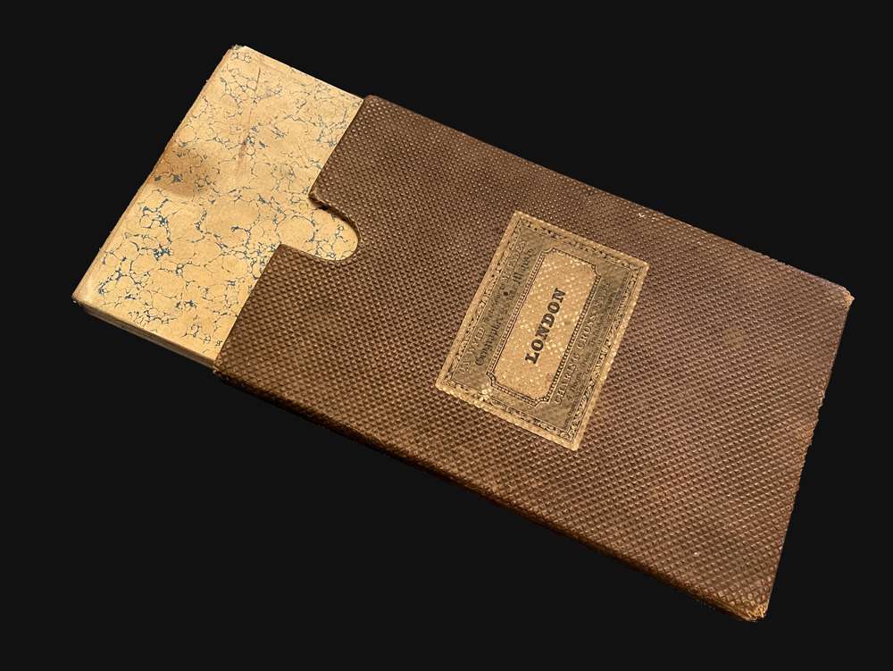
Very good. Slight fold toning. Dissected and laid on linen in 30 panels. Folds into its original slipcase.
References
OCLC 802293459. Howgego, James L., Printed Maps of London circa 1553-1850, #374.