This item has been sold, but you can get on the Waitlist to be notified if another example becomes available, or purchase a digital scan.
1932 Maw Pictorial Map of the City of Quebec, Canada
CityOfQuebec-maw-1932-2$200.00


Title
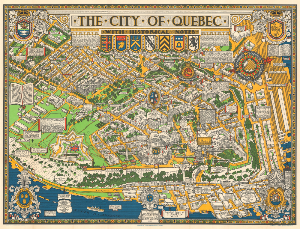
The City of Quebec with Historical Notes.
1932 (dated) 25.5 x 33.5 in (64.77 x 85.09 cm)
1932 (dated) 25.5 x 33.5 in (64.77 x 85.09 cm)
Description
This is an exceptional 1932 Samuel Herbert Maw pictorial map of the city of Quebec, Canada. The map beautifully captures the old city of Quebec in exceptional detail, with the St. Lawrence River around it.
A Closer Look
Individual streets are noted, with buildings, monuments, and parks illustrated beautifully. Several Coats of Arms appear, along with an elaborate compass rose in the top right quadrant. Interesting historical facts are noted throughout. Some of these include 'Site of the Prescott Gate,' 'Approximate position of Boom placed across the River St. Charles,' 'Remains of British fortifications which were constructed in 1785 by order of General Haldimand,' St. Matthews Cemetery The burial place of Thomas Scott brother of Sir Walter Scott,' 'In 1533 Cartier discovered the river to which he gave the name of Saint Lawrence upon whose festival day it was discovered', and several others.Publication History and Census
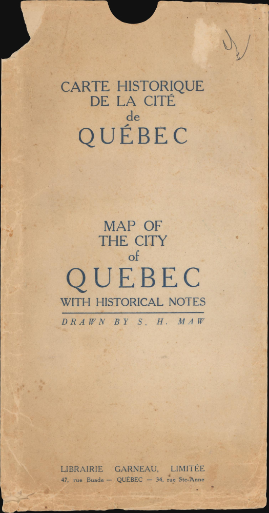
A note in the bottom right corner states, 'this map commenced in 1926, completed in 1932 was drawn by S. H. Maw. Dimensions and proportions must not be taken seriously, it being the intention of the author only to amuse and instruct.' This map was printed by Alexander and Cable Litho. Co. Ltd. and published by Librairie Garneau Ltée. An example is part of the David Rumsey Map Collection, and just over a dozen examples are cataloged worldwide in OCLC.Cartographer
Samuel Herbert Maw (September 12, 1881-1952) was a English engineer, architect, photographer artist, and graphic designer active in Quebec during the first half of the 20th century. Maw was born in England where he attended the Ackworth School. Although not formally trained as an architect, he apprenticed with John. S. Dorden of Ipswich and Edward W. Mountfort, of London. From about 1904 on he worked as a draftsman with the London firm of Bradshaw, Gass and Bolton. In 1912 Maw emigrated to the United States where he became a partner in the firm of Brown and Maw. This must not have worked out, because he relocated to Toronto later in the same year, taking a position with the firm of Darling and Pearson. Maw moved from firm to firm within Canada, briefly working in Toronto, Montreal, Ottawa, and Halifax. During World War II, Maw was assigned to the Engineering and Maintenance Branch of the Naval Service Department in Ottawa. He produced pictorial maps of Quebec City (1932), Montreal, Ottawa (1944), and the Gaspé Peninsula (1929). When Maw died he was working on a similar map of Halifax, but it is unclear if it was ever completed or published. More by this mapmaker...
Condition
Very good. Light wear along original fold lines. Closed margin tear professionally repaired on verso. Slight loss at a few fold intersections.
References
Rumsey 7978.000. OCLC 82799070, 17226032.