
1970 Unique Maps of Tampa Pictorial Map of Clearwater, Florida

This item has been sold.
Welcome to Clearwater and its' Beaches.
The comedy of Clearwater.
Choose a Collection:
This Item
Enquire
The comedy of Clearwater.
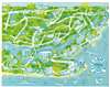
This is a c. 1970 Unique Maps of Tampa pictorial map of Clearwater, Florida. Restaurants, bars, and hotels are illustrated, with yellow signs marking significant locations. A gigantic yellow rocking chair highlights the Rodeway Inn, while an enormous fountain illustrates the Fountain Square Apartments. Cars, buses, trucks, and covered wagons travel Clearwater's roads. Sailboats, sea monsters, and a submarine ply Clearwater Harbor. Two malls and an 'amusement center' also appear, along with Clearwater's miles of Gulf coast beaches.Publication History and Census
This map was created and published by Unique Maps of Tampa, Florida. This is the only known surviving example.Condition
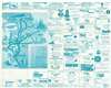
Very good. Exhibits light wear along original fold lines. Verso repair to a fold separation. Text and pictorial map of southern Florida on verso.