1927 Canadian National Railway Map of the Canadian Rockies
TriangleTour-cnr-1927$350.00

Title
The Triangle Tour of British Columbia. / Alaska and the Yukon.
1927 (dated) 17 x 30 in (43.18 x 76.2 cm) 1 : 1500000
1927 (dated) 17 x 30 in (43.18 x 76.2 cm) 1 : 1500000
Description
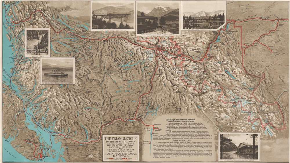
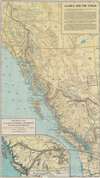
This is a c. 1927 Canadian National Railway map of the Triangle Tour of British Columbia. The map depicts two train and one steamship route, allowing the tourist to experience the 'charm and grandeur' of the wilderness of British Columbia by traveling by rail from Vancouver to Jasper and from Jasper to Prince Rupert and then via steamship from Prince Rupert along the Canadian coastline south to Vancouver.
Persuasive Cartography?
Although at first glance this map appears to be very similar to all other rail maps of the area, the Canadian National Railway is subtlety using this map as a means to 'forget' its competition. Here, the mapmaker employs two different scales and does not delineate exactly where the two meet. In doing so, this map becomes part of a long history of railroad companies using clever cartography to 'emphasize' their own route while strategically leaving out competing lines. In this case, the mapmaker has left out southeastern British Columbia and adjacent Alberta, making it possible for the routes operated by the Canadian Pacific Railway (its major competitor) to be left out, along with its hotel at Lake Louise. By putting forth the suggestion that the Canadian National Railway was the only option for travelers to visit this part of British Columbia, and that its hotel - the Jasper Park Lodge - provided the only accommodations in the area, the Canadian National Railway promoted its own services while 'artistically leaving out' those of its main competitor.A Closer Look at the Map
With this in mind, it is easy to see why locations all along the route are labeled, but the most detail is provided in Jasper National Park near the map's right border. Enticing details of what awaits the tourist are noted, including the Jasper Park Lodge, which features 'all the refinements and comforts the modern tourist demands', along with numerous mountains, lakes, and other lodges. Five photos also adorn the map, allowing the viewer to see the Jasper Park Lodge, Mount Robson in Mount Robson Park, the Fraser Canyon, totem poles in Kitwanga, and a sample of the scenery they will experience on the voyage by steamship from Prince Rupert to Vancouver.Verso Content
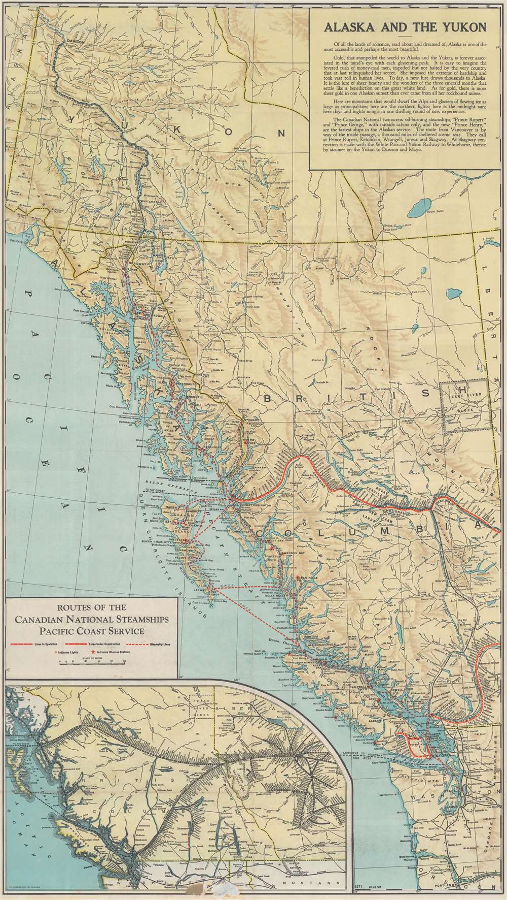
A map of the North Pacific coast from Portland, Oregon to Cape Ocean, Alaska is printed on the verso. Highlighting the Canadian National Railway lines and Canadian National Steamship routes, stops along all the routes are noted and labeled. Railroads emanating from Seattle and Tacoma in Washington are also noted. An inset map of western Canada from the Pacific Ocean to Edmonton features the entire Canadian National Railway network in the British Columbia and Alberta.Publication History and Census
This map was created by the Canadian National Railway and published c. 1927. We note an example of this map in Persuasive Cartography: The PJ Mode Collection at Cornell University. We also are aware of three examples that are cataloged in OCLC and are part of the collections at the University of Missouri - St. Louis, the Denver Public Library, and the University of California Los Angeles.Condition
Very good. Exhibits light wear along original fold lines. Exhibits some surface loss on verso where originally attached to binder. Verso repair to a fold separation. Accompanied by original binder.
References
Cornell University, Persuasive Maps: PJ Mode Collection, 1219.01. OCLC 48575649.