This item has been sold, but you can get on the Waitlist to be notified if another example becomes available, or purchase a digital scan.
1926 Wickwar Map of Colombo, Sri Lanka / Ceylon
Colombo-wickwar-1926$225.00

Title
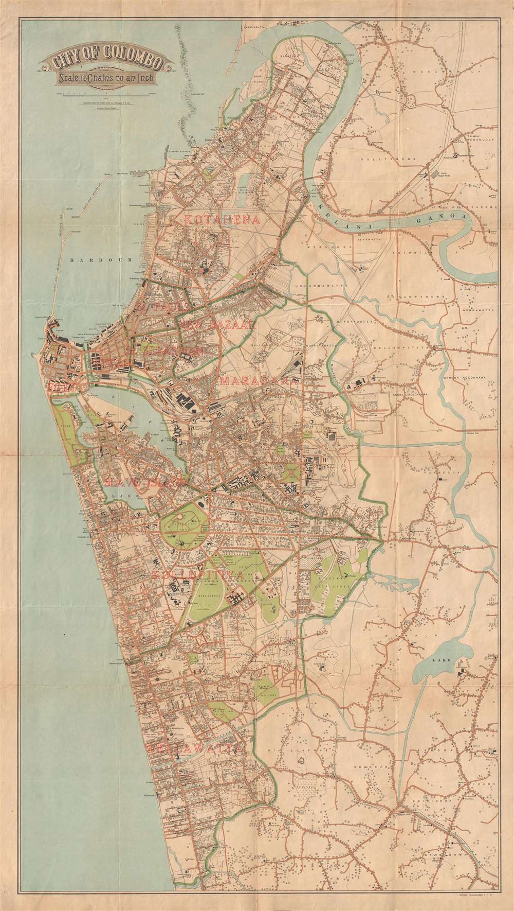
City of Colombo.
1926 (dated) 42.5 x 24 in (107.95 x 60.96 cm) 1 : 12672
1926 (dated) 42.5 x 24 in (107.95 x 60.96 cm) 1 : 12672
Description
A scarce 1926 city plan or street map of Colombo, Sri Lanka, issued by A. J. Wickwar, the Surveyor General if Ceylon. The map covers the historic center of Colombo, from the Kelani Ganga River to the Dehiwala Canal. Magnificently produced, the map details al. major streets as well as important structures, including news agencies, hotels, colleges (Vidyodaya College), government offices, civic structures, important businesses, and more. The map was issued by Ceylon Surveyor General’s office under the orders of A. J. Wickwar, Surveyor General
Cartographer
A. J. Wickwar (fl. 1897 - 1927) was a British colonial officer, tea grower, and surveyor active in Sri Lanka in the late 19th and early 20th Century. He is best known as the 15th Surveyor General of Ceylon. He was appointed in 1923, succeeding W. C. S. Ingles, and held the office until 1927. He was succeeded by A. H. G. Dawson. Little is known of his life. He was in Ceylon as a surveyor as early as 1898, but probably earlier, as the Wickwar family were prominent figures in the Sri Lanka tea trade. Along with Norman Bostock he was instrumental in the building of the Aislaby Tea Estate. Wickwar was a Fellow of the Royal Geographical Society from at least 1919, and also a member of the Piccadilly Badminton Club. More by this mapmaker...
Condition
Very good. Backed on archival tissue. Some wear on original fold lines.