
1937 Shantz and Gray Line Motor Tours Pictorial Map of Colorado Springs, Colorado

This item has been sold.
Seeing Colorado Springs. The Gray Line.
Pictorial Colorado Springs!
- Digital Map Information
- Suitable for large format printing
- Full resolution TIFF file
- ICC color profile embedded
- Delivered instantly via download link
Pictorial Colorado Springs!
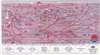
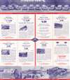
This is a 1937 Fred Shantz pictorial tourist map of Colorado Springs, Colorado, and vicinity. Overlooking the city from the east, Cheyenne Mountain is on the left, Pike's Peak is in the center, and Woodland Park and Divide are on the right. Manitou Springs appears just below Pike's Peak and slightly to the right. Popular tourist sites are illustrated, including the Cheyenne Mountain Zoo, the Will Rogers Shrine of the Sun, Pike's Peak and the Pike's Peak Cog Railway, the Broadmoor Hotel, and the Cave of the Winds. Cheyenne Cañon, Seven Falls, and the Garden of the Gods appear as well. Colorado Springs residents will appreciate that Van Briggle Art Pottery is also labeled! Major streets throughout, such as Nevada Avenue, Tejon Street, Lake Avenue, and Cheyenne Boulevard, are marked by red lines. Cripple Creek, Victor, and the Royal Gorge (billed as the 'world's highest bridge') appear along the top border. Text along the bottom promotes Gray Line tours, including Pike's Peak by car, one of which will get a traveler to the top before sunrise.Publication History and Census
This map was drawn by Fred Shantz and published by Gray Line Motor Tours in 1937. We note five examples cataloged in OCLC which are part of the institutional collections at Yale University, Colorado College, the Pikes Peak Library District, the Denver Public Library, and the University of California Berkeley.Cartographer
Fred H. Shantz (March 19, 1889 - August 1981) was an American artist and cartoonist. Born in Caledonia, Michigan, Shantz was in Colorado Springs by 1900, where worked as an artist and cartoonist in Colorado Springs. Over the decades spent living and working in Colorado Springs, Shantz developed a reputation for his work. Very little else is known about his life. He died at the age of ninety-two in Colorado Springs. He married Iros Gaumer on July 3, 1912, with whom he had four children. Iros died in 1931. Further Details...
Condition
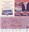
Very good. Map printed on half of sheet. Exhibits wear along original fold lines. Text on verso.
References
OCLC 173691576.