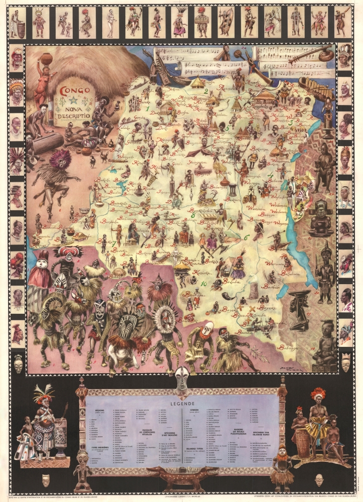
1950 Thiriar Pictorial Map of the Democratic Republic of the Congo
Congo-thiriar-1950-2
Title
1950 (undated) 41 x 30 in (104.14 x 76.2 cm) 1 : 3500000
Description
A Closer Look
The artist James Thiriar participated in the Belgian 1932 Ruwenzori Expedition, during which he was inspired by Congo's rich artistic traditions and cultural tapestry. During the expedition, he created watercolors of the people he encountered, much of which later inspired his commercial work - as here.Coverage embraces from the mouth of the great river to Lake Tanganyika. Indigenous peoples, arts, and musical instruments are faithfully illustrated in their typical and ceremonial costumes. Numerous tribes are named roughly in the correct territory. In the lower left, 17 figures are illustrated wearing ceremonial dance costumes, all numbered and associated with a legend below the map. Likewise, along the right and top, examples of sculpture and musical instruments are illustrated. On either side and along the top are border portraits illustrating the diversity of cultural hairstyles, decoration, and dress.
This map was published to capitalize on Belgian public interest in the Congo, and possibly for distribution to schools. Although celebrating the cultures of the Congo and Thiriar's fascination with it, this map cannot be divorced from the harsh reality of Belgian colonialism. The Belgian occupation of the Congo (1885 - 1960) was infamous for its brutal exploitation of resources and people.
Publication History and Census
This map was created by James Thiriar and published in Brussels by the Centre d'Information ed de Documentation du Congo Belge et du Ruanda-Urundi. An entry appears in OCLC, but it is empty, implying that the affiliated institution has withdrawn from the collective.Cartographer
James Thiriar (January 11, 1889 - October 12, 1965) was a Belgian illustrator, draughtsman, painter, and costume designer. Born in Ixelles, Belgium, Thiriar was a member of the Belgian Civil Guard, a group tasked with civil law and order, at the outbreak of World War I (1914 - 1918). Wounded while fighting with the Civil Guards against the German invasion, he joined the Belgian Army in London. His first job for the Belgian Army was with the Topographic Service, where he created detailed maps and sketches of the frontlines. Thiriar was later transferred to the artistic section, where he produced drawings of the everyday lives of soldiers, many of which were published in The Illustrated London News. He organized exhibitions of his drawings in La Panne and London in 1917 and, under the pseudonym Uilenspiegel, his work appeared in the Belgian French-language magazine L'Yser: Journal Hebdomadaire du Front Belge. His work was also published in the bi-monthly French magazine La Guerre des Nations under the title La guerre sur l'Yser dessinée. He also illustrated Jacques Pirenne's 1917 book Les Vainqueurs de l'Yser. He published his own memoirs about the war, which he also illustrated, entitled Gloire et Misère au Front de Flandres 1914 - 1918. He opened his own studio in Brussels shortly after the war and worked as a costume designer for the Théàtre Royal de la Monnaie and worked for several other theater companies. He also worked on set designs and created advertisements for the SNCF. Thiriar participated in the 1932 Belgian exploratory mission to Ruwenzori and painted several notable watercolors and gouaches of vegetation in Congo and Sudan. He provided 232 illustrations for Fernand Gendarme's three-volume work Croquis Congolais in 1942. More by this mapmaker...

