1831 Wetherall Schoolgirl or Schoolboy Map of Delaware
DelawareSchoolboy-wetherall-1831$750.00

Title
Delaware.
1831 (undated) 11.5 x 8.75 in (29.21 x 22.225 cm) 1 : 590000
1831 (undated) 11.5 x 8.75 in (29.21 x 22.225 cm) 1 : 590000
Description
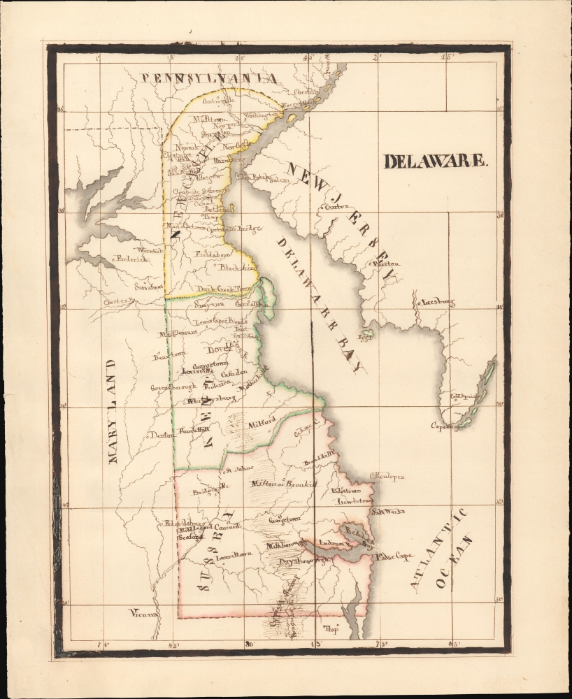
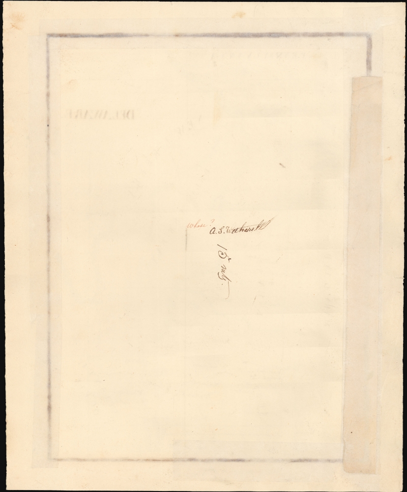
An elegant example of a 19th century schoolgirl/boy map, this manuscript work presents the state of Delaware as of 1831. It is based on Anthony Finley's map of the state and includes the initials and surname of the maker, A. S. Wetherall, on the verso.
This work is based on Anthony Finley's map of Delaware in his New General Atlas. Not every detail from Finley's map is replicated, however. Most notably, roads are omitted, but other details are also forgone, such as shoals in Delaware Bay, a lighthouse at Cape Henlopen, and Fort Delaware on Pea Patch Island.
The goals of these exercises were more far-reaching than teaching geography. They also taught penmanship, each map often using three or more lettering styles. Mapmaking further sharpened the retention and recall of factual information. Students were encouraged to take pains in their draftsmanship, and often achieved beautiful flourishes of artistic expression in their maps. But most peculiar to the American iterations of educational mapping was the goal of instilling a sense of civic pride and responsibility. Indeed, the key desired result of the education in the post-Revolutionary-War United States was to prepare for the education of the next generation of American citizens.
A Closer Look
Coverage includes the state of Delaware divided into counties, along with portions of New Jersey, Pennsylvania, and Maryland. Cities and towns, waterways, areas of elevation, and terrain are illustrated. Notable towards top is the Delaware Canal, opened in 1831, a major clue in helping to date the map.This work is based on Anthony Finley's map of Delaware in his New General Atlas. Not every detail from Finley's map is replicated, however. Most notably, roads are omitted, but other details are also forgone, such as shoals in Delaware Bay, a lighthouse at Cape Henlopen, and Fort Delaware on Pea Patch Island.
Schoolgirl and Schoolboy Maps
While the use of mapmaking in teaching is first seen in Europe, mainly England, the schoolgirl map became a peculiarly American pedagogical tool in the first part of the 19th century, a period in which standards and purposes in women's education were changing. While boys were frequently taught the practical execution of surveys and charts, the production of attractive and informative maps appears to have been primarily the domain of young women. Such maps can be found of the World, the United States, or more specific maps of individual states. These were usually based on generally available reference maps, such as those found in the atlases produced by Carey and Lea, Finley, and Mitchell.The goals of these exercises were more far-reaching than teaching geography. They also taught penmanship, each map often using three or more lettering styles. Mapmaking further sharpened the retention and recall of factual information. Students were encouraged to take pains in their draftsmanship, and often achieved beautiful flourishes of artistic expression in their maps. But most peculiar to the American iterations of educational mapping was the goal of instilling a sense of civic pride and responsibility. Indeed, the key desired result of the education in the post-Revolutionary-War United States was to prepare for the education of the next generation of American citizens.
Publication History and Census
This map was drawn by one A. S. Wetherall, a schoolchild. It is based on Anthony Finley's map of Delaware that appeared in his New General Atlas, first published in 1824, though, as noted above, the inclusion of the Delaware Canal indicates the 1831 edition of the map (Rumsey 0285.016). As a manuscript map, this is an entirely unique work.Cartographer
Anthony Finley (August 25, 1784 - June 9, 1836) was an American book and map publisher based in Philadelphia, Pennsylvania. Finley was born in Philadelphia in 1784. He opened a bookshop and publishing house at the Northeast corner of Fourth and Chestnut Street, Philadelphia in 1809. His earliest known catalog, listing botanical, medical and other scientific works, appeared in 1811. His first maps, engraved for Daniel Edward Clarke’s Travels in Various Countries of Europe, Asia, and Africa also appear in 1811. His first atlas, the Atlas Classica, was published in 1818. He soon thereafter published the more significant A New American Atlas and the New General Atlas…, both going through several editions from 1824 to 1834. Although most of Finley's cartographic material was borrowed from European sources, his atlases were much admired and favorably reviewed. In addition to his work as a printer, Finley ran unsuccessfully on the 1818 Democratic ticket for Philadelphia Common Council. He was a founding officer of the Philadelphia Apprentices’ Library, and a member of both the American Sunday-School Union and the Franklin Institute. He was also an ardent supporter of the American Colonization Society, an organization dedication to returning free people of color to Africa - which led to the founding of Liberia. Much of his wealth was dedicated to supporting this cause. Finley was active as a publisher until his 1836 death, apparently of a 'lingering illness.' Shortly thereafter advertisements began appearing for his map business and plates, most of which were acquired by Samuel Augustus Mitchell. More by this mapmaker...
Condition
Good. Manuscript pen, ink, and original outline color. Oxidation of ink at border resulting in some cracking and loss at lower left, reinforced and reinstated not impacting the body of the map.