This item has been sold, but you can get on the Waitlist to be notified if another example becomes available, or purchase a digital scan.
1845 Chambers Map of Denmark
Denmark-chambers-1845$37.50

Title
Denmark.
1845 (undated) 11 x 9 in (27.94 x 22.86 cm)
1845 (undated) 11 x 9 in (27.94 x 22.86 cm)
Description
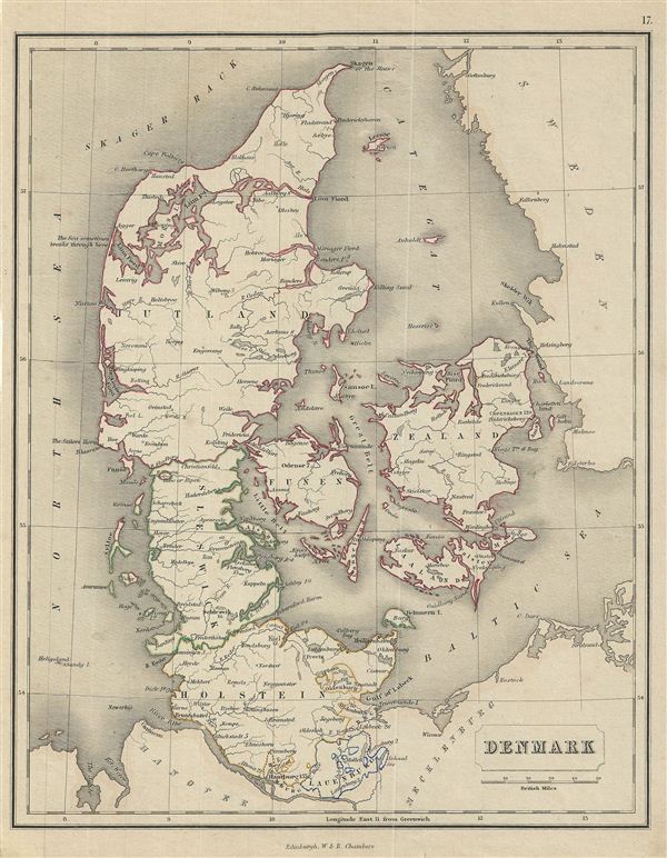
This is a fine example of the 1845 Chambers map of Denmark. The map covers all of Denmark inclusive of the Duchy of Holstein. The Kattegat (Cattegat) is also identified. At this time in history, Scandinavia was in the midst of a prolonged period of peace and prosperity that led to a cultural and population boom. Divided and color coded according to regions and territories, the map identifies various cities, towns, islands, rivers, and an assortment of additional topographical details. This map was drawn and engraved by J. Gellatly.
Cartographer
Chambers (fl. C. 1816 - 1920) was a Scottish bookselling and publishing firm run by brothers William Chambers (April 16, 1800 - May 20, 1883) and Robert Chambers (July 10, 1802 - March 17, 1871). They were born into a prosperous family on the border between Scotland and England. Unfortunately, by puberty their family fortunes had declined due to their father's bad loans to French prisoners of war. Left with little Robert Chambers, then 16, opened a small bookstand on Leith Walk, Edinburgh. His brother William, at 18, opened a bookstand of his own on the same street. A short time afterwards the two joined forces. Due to their thrifty business practices and hard work, the duo quickly developed a thriving business and began publishing. Their first publishing venture was 750 copies of The Songs of Robert Burns, a sure bet in 19th century Edinburgh. They followed up with a series of educational works including several atlases, an encyclopedia, and more Burns books. The firm continued to publish into the early 20th century. More by this mapmaker...
Condition
Very good. Moderate age toning. Blank on verso. Minor verso repair on bottom margin.