
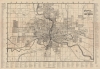
1906 Tate City Plan or Map of Des Moines, Iowa


This item has been sold.
Commercial Club Map of Des Moines, Iowa.
Grassroots urbanization and the City Beautiful Movement in Des Moines.
- Digital Map Information
- Suitable for large format printing
- Full resolution TIFF file
- ICC color profile embedded
- Delivered instantly via download link
Grassroots urbanization and the City Beautiful Movement in Des Moines.
This is a 1906 F. C. Tate city map of Des Moines, Iowa, one of the best early commercial maps of the city. Among other features, it details the development of the Des Moines Inter-Urban Railway and urban planning inspired by the City Beautiful Movement.A Closer Look
Des Moines is shown in detail, with streets labeled and city blocks numbered. Locations throughout are identified, including the Y.M.C.A., numerous companies (including the Iowa Brick Co.), Drake University, and the streetcar power plant. Parks are marked by diagonal lines, as are cemeteries. Several railroads (in addition to the Inter-Urban Railway) run through Des Moines, including the Chicago and Northwestern Railroad, the Chicago, Great Western, and the Minneapolis and St. Louis Railway, and the Chicago, Milwaukee, and Saint Paul Railroad.The Des Moines Inter-Urban Railway
Founded on November 28, 1899, the Inter-Urban Railway was an electric railway that first connected Des Moines to Colfax over a twenty-four-mile route that opened in early 1903. The railway provided both freight and passenger carriage, servicing coal mines and the popular Colfax health resorts. In 1906, the Inter-Urban opened the Beaver Valley Division, which ran from Des Moines to Herrold, Granger, and Perry. It also built a three-mile spur from Moran to Woodward. In addition to passengers and freight, the trains carried Wells Fargo Express and United States Mail. The Inter-Urban later served Camp Dodge, an important military base during World War I and World War II. The Inter-Urban's name changed to the Des Moines and Central Iowa Railway in 1922. During the 1930s and 1940s, the railway's revenues declined, and in 1946, the Colfax line closed. The Des Moines and Central Iowa went bankrupt in November 1946. It was purchased in 1949 by a New York scrap-iron dealer, who began operating the railway with diesel engines rather than electric power. Still, he discontinued passenger service and focused on freight. In 1954, the line from Granger to Perry was abandoned. The Chicago and Northwestern Railroad bought the remaining lines in 1968. Today, the Union Pacific operates its freight tracks.Publication History and Census
This map was drawn by F. C. Tate, printed by the Kenyon Printing and Manufacturing Company of Des Moines, Iowa, and published by the Commercial Club. This is the only known cataloged example, as it does not appear in OCLC or in digitized archival records from Iowa. However, this map is referenced in the application to make the Highland Park Historic Business District at Euclid and Sixth Avenues part of the National Register of Historic Places.Cartographers
Frank C. Tate (September 13, 1870 - January 8, 1916) was a Des Moines, Iowa, based businessman and draughtsman. Tate was born in Iowa. The earliest records we find, 1893, place him as an engraver for the Iowa Engraving Company - likely his own enterprise as it is based out of him home at 1110 East 6th Street. In 1894 he appears as a draftsman for the State Geological Survey. In 1903, we find him as a clerk for the Royal Union Mutual Life Insurance Company. In the 1908 directory, he is identified as a draftsman for the Interurban Railway. In the 1915 Des Moines directory he is listed as both the owner of Tate Chemical Company (a compounding pharmacy) and as a draftsman with the Union Improvement Company, both at 1110 East 6th Ave. Earlier records (1907 - 1911) indicate that Tate Chemical was owned by John C. Tate, possibly a brother, so likely Frank inherited it. Frank died in Des Moines in 1916. Further Details...
The Kenyon Company, Map Makers (fl. 1874 - c. 1930) was an American printing and publishing firm based in Des Moines, Iowa. The company published maps, atlases, and books, and advertised their high-grade calendars in the Des Moines Tribune. Further Details...
Condition
Good. Toning. Wear along original fold lines. Verso repairs to fold separations and at fold intersections. Small areas of loss at some fold intersections.