1770 Seven Years’ War Manuscript Map of Dunkirk, France
Dunkirk-ecolemilitaire-1770$850.00
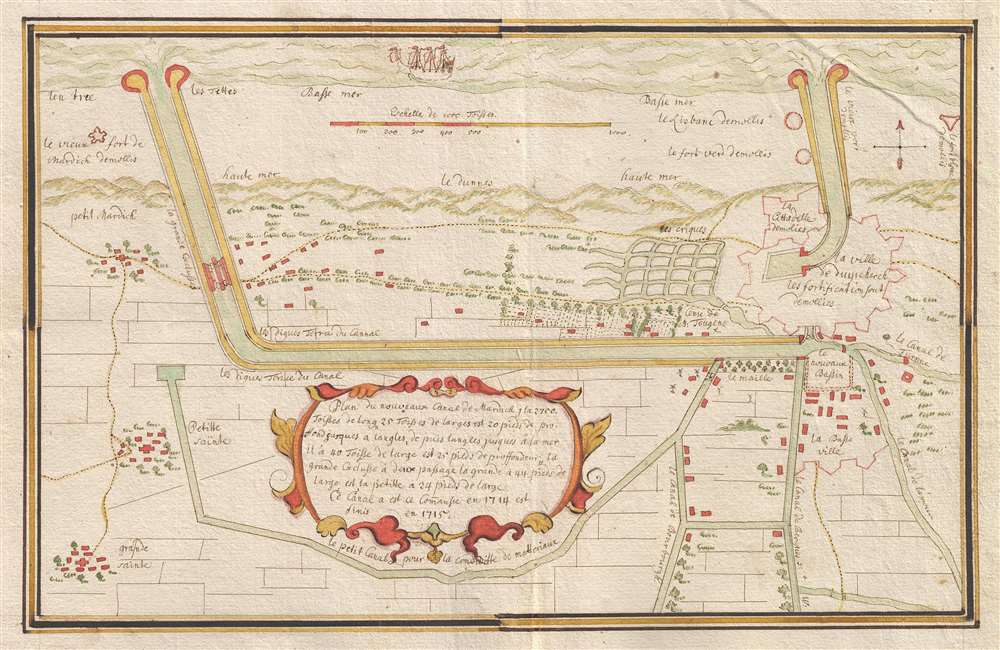

Title
Plan du Nouveau Canal de Mardick…
1770 (undated) 8 x 12.5 in (20.32 x 31.75 cm) 1 : 20000
1770 (undated) 8 x 12.5 in (20.32 x 31.75 cm) 1 : 20000
Description
A finely executed 18th century manuscript map of Dunkirk, France illustrating both the old and new ship canals. Probably dating from the Seven Years' War (1756 - 1763) or slightly after, this map focuses on the two major canals giving access to Dunkirk's harbor. The Canal du Mardick takes center stage and is just above the cartouche. An older ship's canal, in the upper right, provides access to the old citadel. It was part of Vauban's Pré Carré, a system of fortresses protecting northern France from naval attack. Dunkirk was of special significance as the primary access point to French inland navigation. Canals extending south from the Canal du Mardick, including the Canal de Furnes, Canal de Burgues, the Canal de Bourburg, connect to France's major northwestern rivers, including the Aa, the Escaut, the Lys, and the Furnes.
Publication History
The map is unsigned and its author is not known. Its style and format are consistent with maps and charts produced by students of a French Ecole Militaire, and was likely drawn by a hand trained in French military mapping protocols.Condition
Very good. Some creasing. Backed on paper.