
This item below is out of stock, but another example (left) is available. To view the available item, click "Details."
Details
1916 Ordnance Survey Map of German East Africa, Mahenge Region, World War I
1916 (dated) $750.00
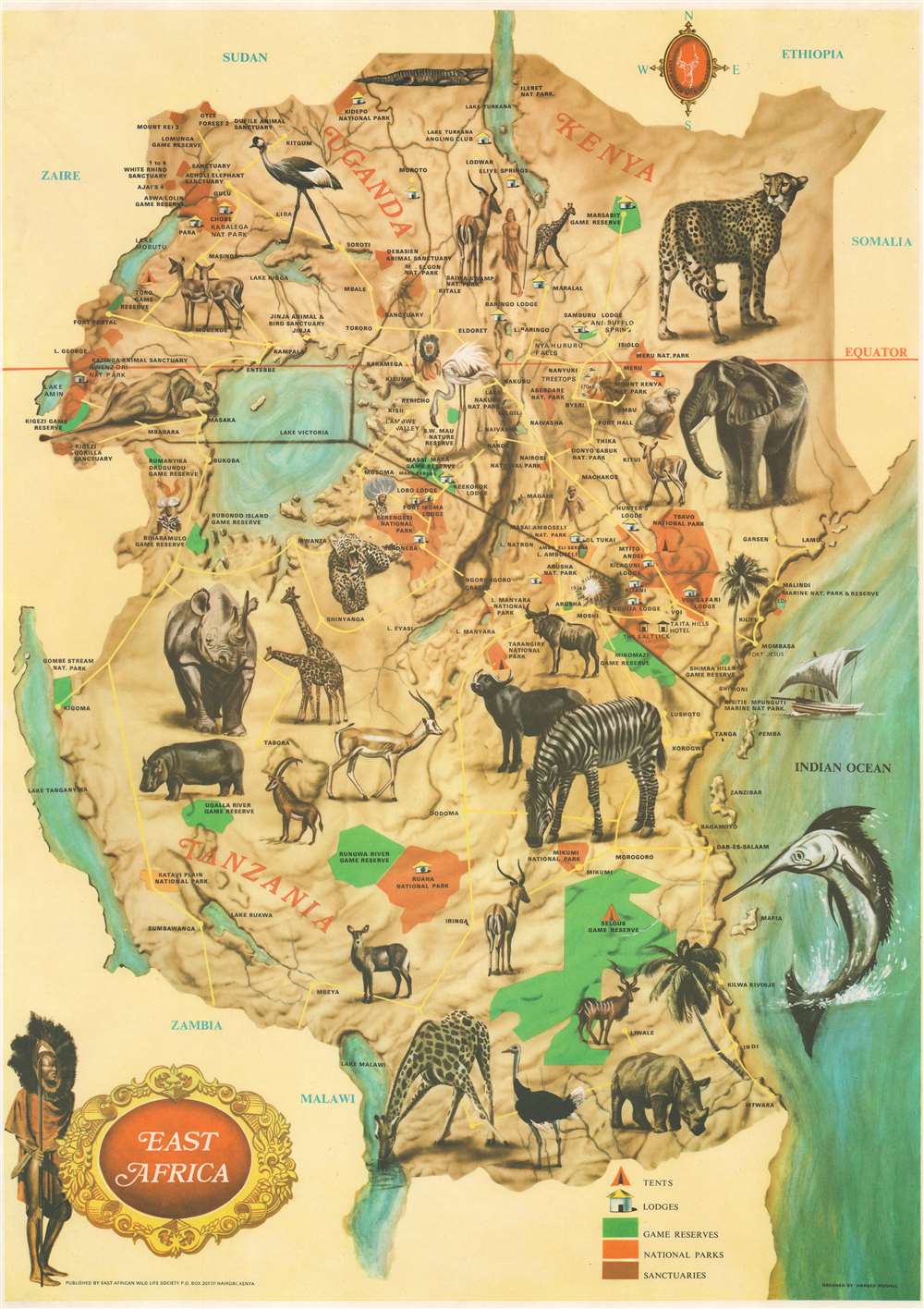
1970 Moghul Pictorial Map of East Africa (Kenya, Tanzania, Uganda)
EastAfrica-mughal-1970$150.00

Title
East Africa.
1970 (undated) 26.5 x 19 in (67.31 x 48.26 cm)
1970 (undated) 26.5 x 19 in (67.31 x 48.26 cm)
Description
This is a c. 1970 Hameed Moghul pictorial map of East Africa, including Kenya, Tanzania, and Uganda. Wonderful color illustrations of iconic African wildlife, including a cheetah, rhinoceros, elephant, zebra, and giraffe. These portraits provide a framework for the map, which highlights national parks (orange) and game reserves (green). The Rift Valley Lakes, such as Lake Victoria, Lake Tanganyika, and Lake Malawi, are illustrated and labeled. Icons mark lodges, hotels, and campsites (tents), and are explained in a legend in the lower right. Yellow lines trace major road networks.
Publication History and Census
This map was designed by Hameed Moghul and published by the East African Wild Life Society c. 1970. An empty OCLC reference exists for this map, suggesting that a former cooperative member created it. Examples of other editions are present in institutional collections. We are aware of two other examples in private hands.Condition
Very good.
References
OCLC 1056475378.