This item has been sold, but you can get on the Waitlist to be notified if another example becomes available, or purchase a digital scan.
1901 Railroad Map of the Eastern United States
EasternUnitedStates-railwaypublishing-1901$147.50

Title
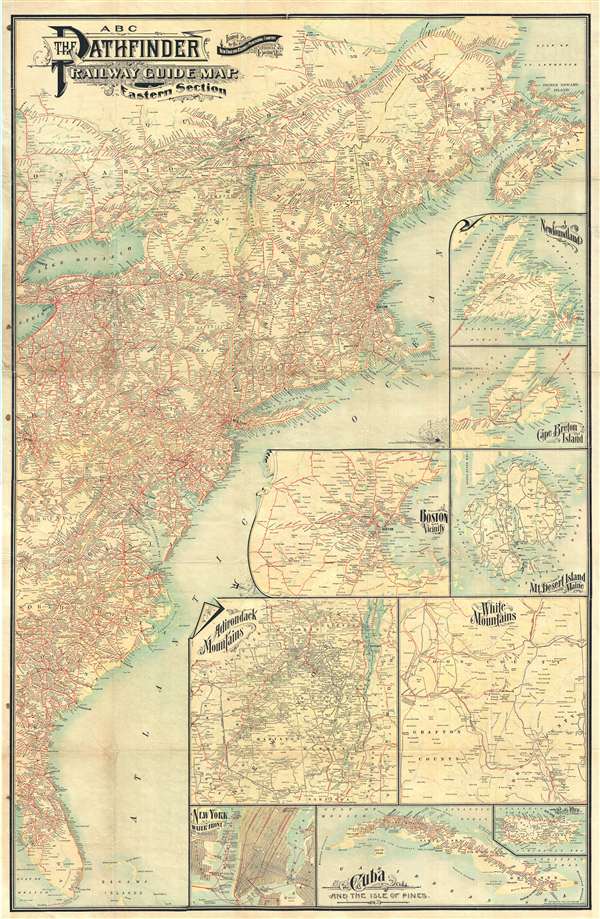
ABC The Pathfinder Railway Guide Map. Eastern Section.
1901 (dated) 44 x 28.5 in (111.76 x 72.39 cm) 1 : 2473000
1901 (dated) 44 x 28.5 in (111.76 x 72.39 cm) 1 : 2473000
Description
A very attractive large format 1901 railroad map of the eastern part of the United States. The map covers the Atlantic Seaboard from Nova Scotia to the Florida Keys and extends west far as Lake Erie and Cedar Key. An array of 9 inset maps fill the Atlantic Ocean, extending the scope of the map to include Newfoundland, Cape Breton Island, Cuba and Porto Rico. Other insets include Boston, Mount Desert Island (Acadia), the Adirondack Mountains, the White Mountains, and New York City. Rail lines appear in red.
Cartographer
The New England Railway Publishing Company (fl. c. 1900 – 1920) was a Boston based publisher of railroad maps and guides. Most of their guides were promoted under the 'ABC Pathfinder' brand, but they also published the 'Nickel Pathfinder' and the 'Baby Pathfinder.'. The company maintained offices at 67 Federal Street, Boston. More by this mapmaker...
Condition
Very good. Backed on archival tissue. A few minor splits repaired and reinforced on verso. Wear on original fold lines.