This item has been sold, but you can get on the Waitlist to be notified if another example becomes available, or purchase a digital scan.
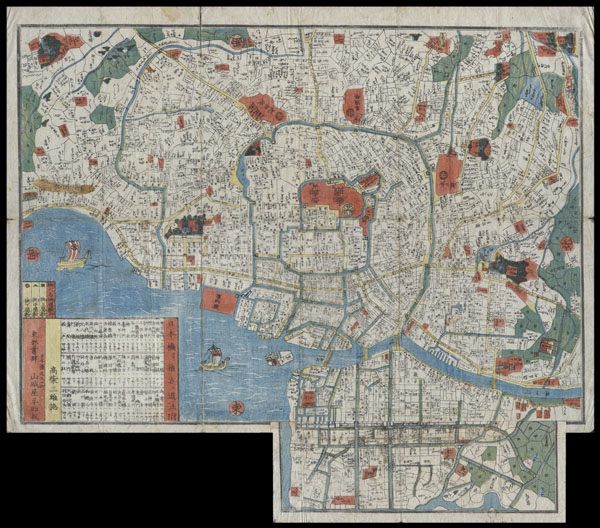
1850 Edo Period Woodcut Map of Edo or Tokyo, Japan
EdoSm-japan-1850$349.50

Title
Edo.
1850 17 x 19 in (43.18 x 48.26 cm)
1850 17 x 19 in (43.18 x 48.26 cm)
Description
This extraordinary item is a hand colored Edo Period woodcut map of Edo, or Tokyo, Japan. Impressive level detail. This map is in fact a smaller variation on a larger map printed in 1849. Produced in the mid 19th century Japanese woodcut style, this map is a rare combination of practical and decorative. Ships and waves decorate the harbor and there is no specific directional orientation. All text seems to radiate from the center of the map. Folds into its original sideboards. A must for any serious collection of Japanese cartography.
Condition
Very good condition. Folds into small booklet. Minor stains on left side of image. Minor damage on original folds. Good margins. Blank on verso.