This item has been sold, but you can get on the Waitlist to be notified if another example becomes available, or purchase a digital scan.
1900 Harris Map of Southern Africa
EmigrantFarmers-harris-1900$100.00

Title
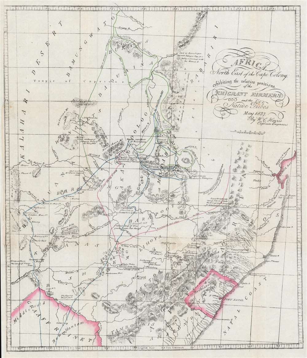
Africa, North East of the Cape Colony exhibiting the relative positions of the Emigrant Farmers and the Native Tribes.
1900 (undated) 19.75 x 17 in (50.165 x 43.18 cm) 1 : 3168000
1900 (undated) 19.75 x 17 in (50.165 x 43.18 cm) 1 : 3168000
Description
This is a c. 1900 William Cornwallis Harris map of southeastern Africa. The map depicts the region from Graaff Reinet to Delagoa Bay and from the Kalahari Desert to Graaf Reinet. Originally published in Harris's book The Wild Sports of Southern Africa, the map traces the route Harris followed during his 1837 - 1838 hunting trip in the area using a line highlighted in blue. The green line follows the peregrinations of David Hume, a Scottish explorer and big game hunter. Noteworthy for its level of detail, Harris references numerous tribes by name, making it abundantly clear that the territory was not 'deserted' as some would have had you believe at the time of this map's original publication. Harris's geography also is not perfect, but he created this piece by basing it on a map published by Arrowsmith in 1834 and then adding, as Norman Etherington puts it, 'many details obtained during his travels in the interior'.
Publication History and Census
This map was created by William Cornwallis Harris to for publication in his book entitled The Wild Sports of Southern Africa, which was first published in 1838. Many subsequent editions have been published, and we believe this example to come from an edition that was published c. 1900 because of the combination of the printing technique and the paper.Condition
Good. Backed on archival tissue for stability. Remargined along left side. Blank on verso.
References
Etherington, Norman. 'A False Emptiness: How Historians May Have Been Misled by Early Nineteenth Century Maps of South-Eastern Africa', Imago Mundi Vol. 56 No. 1, p. 67 - 86. OCLC 556282474.