1864 Meyer Map of England and Wales
England-meyer-1864$150.00
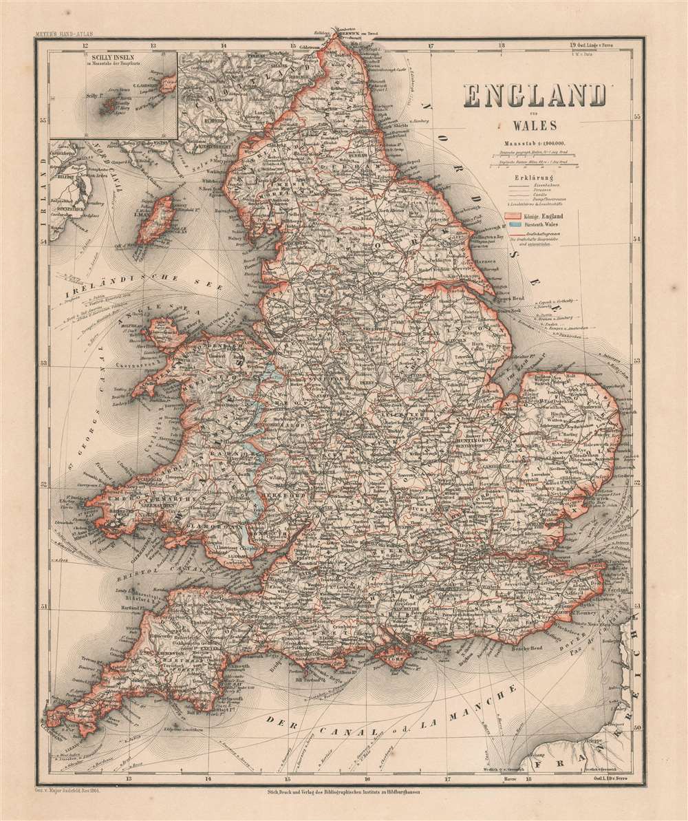

Title
England und Wales.
1864 (dated) 15.5 x 13 in (39.37 x 33.02 cm) 1 : 1900000
1864 (dated) 15.5 x 13 in (39.37 x 33.02 cm) 1 : 1900000
Description
A lovely 1864 Joseph Meyer map of England and Wales that features an inset of the Isles of Scilly in the upper left corner. Popular with birders, Scilly is located twenty-five miles off the southwestern tip of Cornwall. As a whole, the map provides an extraordinary level of detail. Cities and towns are labeled throughout, and maritime trade routes throughout the world are illustrated and identified.
Publication History
This map was created for and published in the 1860 edition of Meyer's Hand-Atlas.Cartographer
Joseph Meyer (May 9, 1796 - June 27, 1856) was a German industrialist, merchant, and publisher, active in Germany in the early to mid 19th century. He is best known for publishing the encyclopedia Meyers Conversation-Lexicon. Born in Gotha, Germany, Meyer was educated as a merchant in Frankfurt am Main. He moved to London in 1816, but returned to Germany in 1820 after his stock speculations and business adventures fell through. Once back in Germany, he began by investing in the textile trade (1820 - 24). Meyer began creating business plans concerning how to start railways soon after the first steam-hauled railway began operation in December 1835. He founded the Deutsche Eisenbahnschienen-Compangie auf Actien (German Railway Rail joint stock company) in 1845. Meyer also found great success as a publisher, utilizing the system of serial subscriptions to publications, a new idea for the time. He founded a company, Bibliographisches Institut in Gotha in 1825, which published several versions of the Bible, works of classical literature, atlases, the world in pictures on steel engravings, and an encyclopedia. He moved the Institut from Gotha to Hildburghausen in 1828. He published several atlases, including Meyer's Groẞer Hand-Atlas (1843 - 1860). In 1848, he supported the Springtime of the Peoples Revolutions that took place throughout Germany and much of Europe. When the revolutions failed in 1849, Meyer was briefly imprisoned for his support of revolutionary activities. The revolutions also began to take a toll on Meyer's business interests, and when he died, in 1856, the Bibliographisches Institut was struggling financially. His son, Herrmann Julius Meyer, took over the firm, spearheading a rapid recovery. This, and other businesses prospered under Herrmann Julius (April 4, 1826 - March 12, 1909) and when he died in 1909, he led the richest family in Saxony, with more total wealth than the King of Saxony More by this mapmaker...
Condition
Very good. Even overall toning. Blank on verso.