
This item below is out of stock, but another example (left) is available. To view the available item, click "Details."
Details
1851 Black Map of England and Wales (Set of 2 Maps)
1851 (undated) $200.00
1840 Black Map of England and Wales
EnglandWales-black-1840$50.00

Title
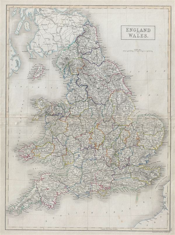
England and Wales.
1840 (undated) 21 x 16 in (53.34 x 40.64 cm)
1840 (undated) 21 x 16 in (53.34 x 40.64 cm)
Description
A fine example of Adam and Charles Black's 1840 map of england and Wales. The map covers both england and Wales from Northumberland to Cornwall and includes the Isle of Man. During this time, both england and Wales were in the midst of the Industrial Revolution wherein much of the rural agricultural population relocated to urban centers. This map was engraved by S. Hall for issue in the 1840 edition of Black's General Atlas.
Cartographer
Charles and Adam Black (fl. 1807 - present) were map and book publishers based in Edinburgh. Charles and his uncle, Adam, both of Edinburgh, Scotland, founded their publishing firm in 1807. They published a series of maps and atlases throughout the 19th century. In addition to an array of atlases, the Black firm is known for their editions of the Encyclopedia Britannica (1817 - 1826) and the first publishing of Sir Walter Scott's novels in 1854. In 1889 the A. & C. Black publishing house moved to London where it remains in operation to this day. More by this mapmaker...
Source
Hall, Sydney, Black's General Atlas: A series of Fifty-Four Maps from the Latest and Most Authentic Sources, Engraved on Steel, In the First Style of the Art, (Edinburgh: Adam and Charles Black) 1840.
Condition
Very good. Blank on verso. Original centerfold. Original platemark visible. Verso repair extending approximately 2 inches from left center margin with similar verso repair on right center margin, not extending onto printed area.
References
Rumsey 2305.015 (1854 edition). Philips (atlases) 4334.