1876 Walker Map of Eastern Englewood, New Jersey
EnglewoodEast-walker-1876$175.00

Title
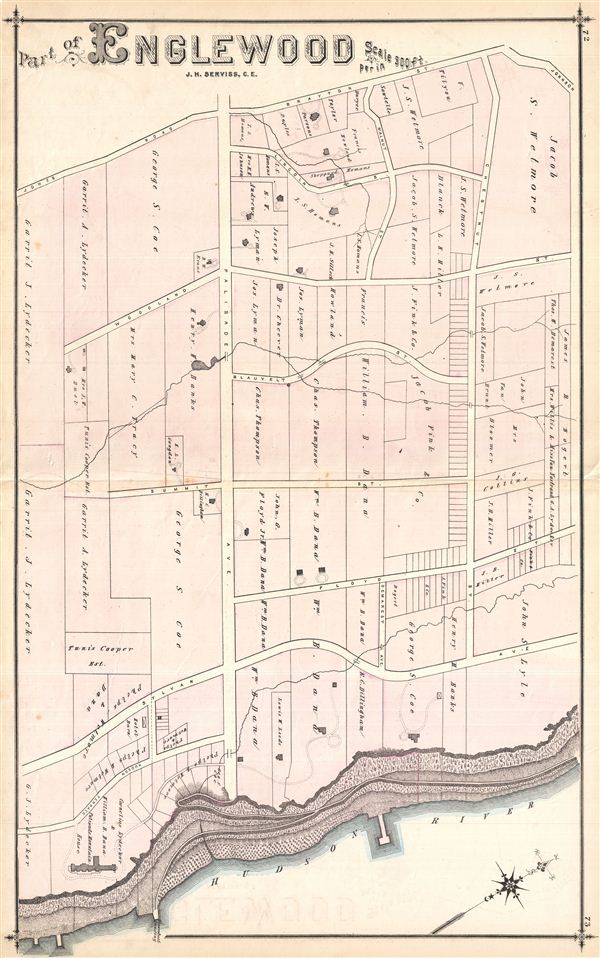
Part of Englewood.
1876 (undated) 16.75 x 27.25 in (42.545 x 69.215 cm)
1876 (undated) 16.75 x 27.25 in (42.545 x 69.215 cm)
Description
Very detailed 1876 map of the eastern-most portion of Englewood, showing roads and property owners' names, and building footprints. Published as plates 72-73 in Walker & Pease' exquisite 'topographical, illustrated, historical, descriptive' Atlas of Bergen County, New Jersey, 1876. Blank on verso.
Source
Walker, A. H., and Pease, C. C. Atlas of Bergen County, New Jersey, 1876.
Condition
Good. Even overall toning. Original centerfold exhibits some wear and in verso reinforcement. Minor discolorations here and there. Edge wear mostly confined to margins.
References
Phillips (Atlases) #2152.