
1919 Gale and Polden Flag Chart of the British Empire and the World



This item has been sold.
Flags of the British Empire.
Recognizing friends and enemies at sea.
- Digital Map Information
- Suitable for large format printing
- Full resolution TIFF file
- ICC color profile embedded
- Delivered instantly via download link
Recognizing friends and enemies at sea.
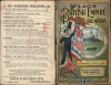
This is a c. 1919 Gale and Polden flag chart combining the emblems of the British Empire and other nations with practical instructions for maritime identification and communication. The Royal Standard dominates a composition that places British sovereignty at the center, colonial badges below, and foreign flags to either side. Semaphore, Morse code, distress signals, and international signal flags make the sheet a compact visual handbook of communication at sea. Corner photographs extend its subject from heraldry to naval technology, pairing capital ships with a submarine, an airship, and an early naval airplane.A Closer Look
The central panel distinguishes flags by function as well as allegiance. Above the Royal Standard are St. George's Cross, the Union Flag, and the ensigns identified with the Royal Navy, Royal Naval Reserve, merchant marine, and Admiralty vessels. Surrounding compartments identify military, diplomatic, and departmental flags, including those of the Board of Trade, Customs, and War Office. The arrangement presents the empire through its institutions and offices rather than through territorial boundaries.The broad lower panel, headed Colonial Flags and Badges, brings together such distant possessions as Hong Kong, Jamaica, Fiji, the Falkland Islands, and British North Borneo. Australian and New Zealand ensigns appear alongside individual colonial badges and governors' flags. At the outer edges, the flags and burgees of royal yacht clubs are accompanied by their home stations and establishment dates. These panels connect imperial administration with the maritime institutions through which British identity was displayed overseas.
The foreign flag tables likewise distinguish royal standards, naval ensigns, and merchant flags rather than assigning a single flag to each country. China's imperial dragon flags appear alongside a republican merchant flag, while Germany, Austria-Hungary, Russia, and Turkey retain monarchical or imperial emblems. The chart therefore preserves an assemblage of designs that should not be read as a uniformly updated survey of the postwar political world.
Across the upper portion, the British semaphore alphabet is accompanied by instructions for opening, answering, and ending communications. Morse tables include timing instructions for flashing signals, while separate panels explain international code flags, pilot signals, and distress signals. A highly specific table beneath the central panel illustrates the signals used for communication between fishery cruisers and fishing vessels in the North Sea. These subjects also appear in the publisher's contemporary advertisement for the chart.
The four corner photographs show H.M.S. Lion, H.M.S. King George V, submarine E.2, and the naval airship Parseval above a naval waterplane. Captions supply armament or operating information, making these illustrations part of the sheet's instructional content. Their juxtaposition presents several forms of naval power within the same decorative border.
Publication History and Census
The chart was printed and published by Gale and Polden Ltd. The lower imprint names 2 Amen Corner, London; Wellington Works, Aldershot; and Nelson House, Portsmouth, and gives the price as one shillingThis undated example is provisionally assigned to c. 1919. The chart was already part of Gale and Polden's publishing program by 1916: an advertisement in the fifth edition of Regimental Nicknames and Traditions of the British Army offers Flags of the British Empire and National Flags for one shilling and enumerates the same principal instructional panels. This image had a long print run across many variants, but specific editions can still be scarce.
Cartographer
Gale and Polden (fl. 1888 - 1981) was a British firm of printers, military publishers, and mapmakers, established at Brompton near Chatham, Kent, and subsequently based at Aldershot, Hampshire, with additional offices in London and Portsmouth. Its origins lay in a bookshop James Gale opened in the 1860s, from which he developed a printing business serving the neighboring military establishment. Thomas Ernest Polden entered Gale's employment as an apprentice and subsequently became his partner; the partnership is dated to 1888. Maps formed a practical component of the firm's military publishing program. Its lithographed The Military Map of Aldershot and Surrounding Country, dated 1888, claimed a special survey made that year and appeared at a scale of three inches to the mile, or 1:21,120. It identified barracks, rifle ranges, military headquarters, and supply facilities, along with roads, railways, waterways, contours, and spot heights, providing detailed topographical information for the garrison district. A further edition is recorded for 1893. The business was incorporated in 1892, and printing moved to the new Wellington Works at Aldershot in 1893; publication of the Aldershot News began the following year. Alongside separate maps, Gale and Polden issued military manuals and histories that incorporated cartographic material, including A Handbook of the Boer War (1910), which featured a general map of South Africa and eighteen sketch maps and plans. These publications establish its role as a publisher of military cartography, although individual maps were not necessarily surveyed, drawn, or printed by the firm itself. Gale and Polden was acquired by the Purnell Group in 1963 and subsequently became part of the British Printing Corporation. The Aldershot business closed in November 1981. Further Details...
Condition
Good. Laid down on linen, poster style, and stabilized. Wear and repaired splits along original fold lines.
References
Regimental Nicknames and Traditions of the British Army, fifth edition, (London: Gale and Polden Ltd., 1916), unpaginated publisher's advertisement for Flags of the British Empire and National Flags. Erfgoedbibliotheek Hendrik Conscience, 798588, related undated edition.