1989 Stuart Henderson Pictorial Map of Florence, Oregon
FlorenceOregon-henderson-1989$250.00

Title
Florence Oregon Area.
1989 (dated) 22 x 18.5 in (55.88 x 46.99 cm)
1989 (dated) 22 x 18.5 in (55.88 x 46.99 cm)
Description
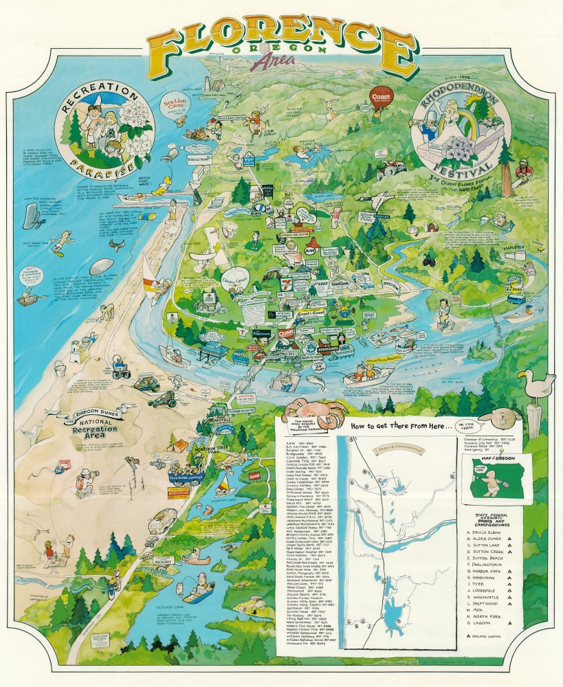
A charming piece, this is a 1989 Stuart Henderson pictorial map of Florence, Oregon. Situated at the mouth of the Siuslaw River, Florence is unofficially known as 'Oregon's coastal playground' and is not far from the famous Sea Lion Caves.
A Closer Look
With Florence, Oregon, at center, the map illustrates the Pacific coast from the Oregon Dunes National Recreation Area north to Seattle (marked by the Space Needle) and Vancouver. Billboards and signs identify businesses throughout and range from local businesses to national chains like 7-Eleven and Dairy Queen. The Siuslaw River winds its way to the Pacific with Florence occupying a bend in the river. Dune buggies and 4-wheelers race around the Oregon Dunes, and a hot air balloon marks the Sea Lion Caves, home to hundreds of sea lions. Caricatures of tourists and locals are illustrated fishing, boating, waterskiing, and generally enjoying this 'recreation paradise'. Small captions provide historical facts and tourist information. An inset in the lower right contextualizes Florence in the greater region and includes a list of local businesses.Publication History and Census
This map was created and published by Stuart Henderson in 1989 in Florence, Oregon. No known collection or market history.Cartographer
Stuart Henderson (19?? - present) is a contemporary artist who lives and works in Florence, Oregon. Henderson is a painter, graphic designer, and lithographer who has had numerous exhibitions of his work in several cities in Oregon. More by this mapmaker...
Condition
Very good. Crease to upper right corner in margin.