This item has been sold, but you can get on the Waitlist to be notified if another example becomes available, or purchase a digital scan.
1922 Clason Map of Florida promoting Bradenton
Florida-clason-1922$50.00
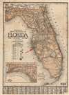

Title
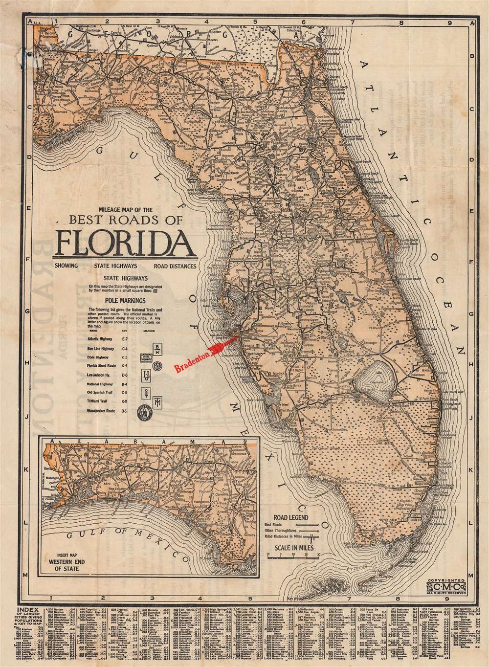
Milage Map of the Best Roads of Florida.
1922 (undated) 16.25 x 12 in (41.275 x 30.48 cm) 1 : 1520000
1922 (undated) 16.25 x 12 in (41.275 x 30.48 cm) 1 : 1520000
Description
This is a c. 1922 Clason Map Company road map of Florida issued to promote real estate development in Bradenton, just south of Tampa. The map covers all of Florida, with the west Florida panhandle included via an inset. The map details major roadways throughout the state as well as roads under construction, such as Tamiami Trail across the Everglades from Miami. Just to the north is the Seminole Indian Reservation known as 'Big Cypress'.
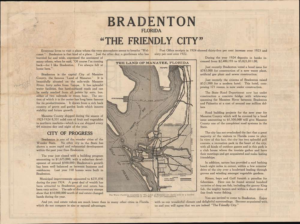
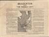
Bradenton 'Friendly City'
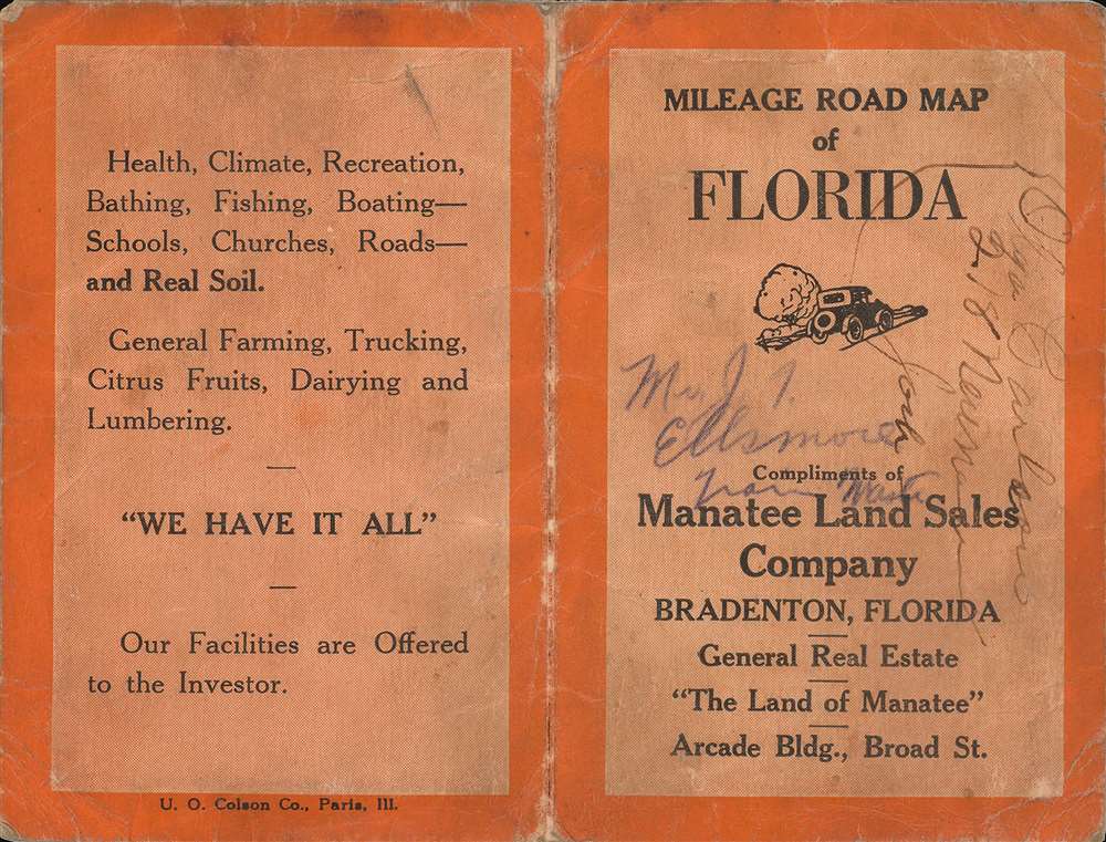
This map was issued in multiple editions, many with overprinting and verso printing to highlight various real estate developments and communities. The present map highlights Bradenton, the capitol of Manatee County, just south of Tampa Bay. Although Bradenton was settled in 1842, the modern city was not incorporated until 1903 - leading to a rush of development in the early decades of the 20th century. The verso contains a detail map of Bradenton, as well as promotional text advertising 'The Friendly City'.Publication History and Census
This map was printed by the Clason map Company. It was issued in many editions - the Touchton Map Library at the Tampa Bay History Center has no fewer than 13 different examples. Although undated, we have been able to tentatively date this map between 1920 and 1922, when the Tamiami Trail was under construction.Cartographer
George Samuel Clason (November 7, 1874 - 1957) was born in the city of Louisiana, Missouri in 1874. As a young man, Clason studied at the University of Nebraska before joining the United States Army in 1898 to fight in the Spanish American War. After the war, he moved to Denver, Colorado where in 1905 he founded the Clason Map Company, thus starting his lucrative publishing career. Clason initially focused on mining and mineral maps - capitalizing on the Colorado and Nevada mining industry, but quickly transitioned to railroad maps, city maps, and by the 1920s, road maps. As the company expanded, Clason opened a secondary office in Chicago, Illinois - then a rising map publishing center and railroad hub. At least one other satellite office was opened in Los Angeles. Among his many achievements, Clason is credited with producing the first modern road atlas of the United States. In the late 1920s, Clason also published a series of get-rich-quick pamphlets in the form of parables. The most famous of these is The Richest Man in Babylon. This tells the story of Arkad, a citizen of Babylon famed for his great wealth and generosity who shares his wit and wisdom with his fellow Babylonians. In 1949, Clason moved to Napa, California to retire and found a social club for retired gentlemen. More by this mapmaker...
Condition
Good. Minor infill in the upper left corner, where originally attached to binder. Accompanied by original binder.
References
Tampa Bay History Center, Touchton Map Library, #L2019.065.045.