This item has been sold, but you can get on the Waitlist to be notified if another example becomes available, or purchase a digital scan.
1845 Morse and Breese Map of Florida
Florida-morsebreese-1845$100.00

Title
Florida.
1845 (dated 1842) 14.75 x 11.5 in (37.465 x 29.21 cm) 1 : 2100000
1845 (dated 1842) 14.75 x 11.5 in (37.465 x 29.21 cm) 1 : 2100000
Description
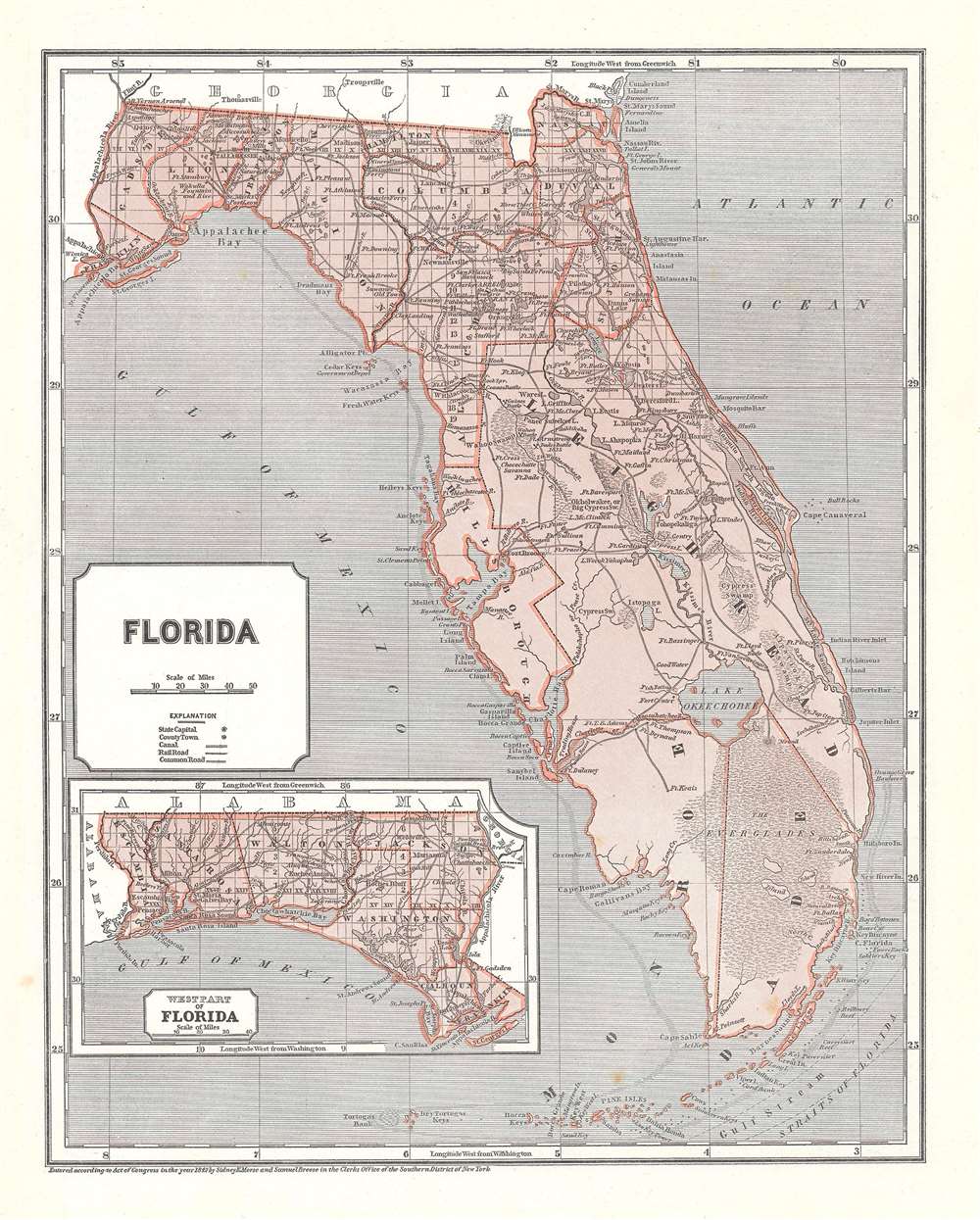
This is an 1845 Sidney Edwards Morse and Samuel Breese map of Florida. The map depicts the state from the Apalachicola (Appalachicola) River to the Atlantic Ocean and from Georgia to the Straits of Florida and the Florida Keys. Wonderfully engraved, numerous cities, towns, and villages are identified, including Tallahassee and St. Augustine. Counties are illustrated and labeled with the township grid illustrated as well. Roads and rivers traverse the state. Several battles from the Seminole Wars are also noted, as are the Everglades. An inset map in the lower left corner depicts the western panhandle from the Apalachicola River to Alabama and from Alabama to the Gulf of Mexico. Cities, towns, and villages are identified here as well, as are counties. The township grid is also illustrated, as are roads, rivers, creeks, and bays.
This map was created by Sidney Edwards Morse and Samuel Breese and published in the 1845 edition of The Cerographic Atlas of the United States.
This map was created by Sidney Edwards Morse and Samuel Breese and published in the 1845 edition of The Cerographic Atlas of the United States.
CartographerS
Sidney Edwards Morse (February 7, 1794 - December 24, 1871) was an American geographer, journalist, and inventor. Born in Charlestown, Massachusetts, Morse was the son of the geographer and clergyman Jedidiah Morse (August 23, 1761 - June 9, 1826) and his wife Elizabeth Ann Finley Breese. Morse graduated from Yale in 1811, and also studied theology at Andover Seminary, as well as law at the school in Litchfield, Connecticut. Morse moved to New York City in 1823, where he founded the New York Observer with his brother Richard Cary Morse (1795 - 1868). Together with Henry A. Munson he developed cerography, a printmaking technique using a layer of wax over a metal substrate. Morse used this technique to illustrate his geographical textbooks, including the The Cerographic Atlas of the United States, which he co-published with Samuel Breese. Morse devoted his last few years to experimenting with an invention, called a bathyometer, created to aid in the rapid exploration of the ocean. His invention was exhibited in Paris during the 1869 World's Fair and the following year in New York City. More by this mapmaker...
Samuel Breese (September 27, 1802 - October 14, 1873) was an American cartographer who co-published The Cerographic Atlas of the United States with Sidney Edwards Morse. Learn More...
Source
Morse, S. and S. Breese, The Cerographic Atlas of the United States (New York: Harper and Brothers) 1845.
Condition
Very good. Even overall toning. Light foxing. Blank on verso.
References
Touchton Map Library M264. Rumsey 2301.031.