This item has been sold, but you can get on the Waitlist to be notified if another example becomes available, or purchase a digital scan.
1950 Rand McNally Map of Florida
Florida-randmcnally-1950$50.00


Title
Rand McNally Standard Map of Florida. / Rand McNally Road Map Florida.
1950 (undated) 27 x 19.5 in (68.58 x 49.53 cm) 1 : 1204000
1950 (undated) 27 x 19.5 in (68.58 x 49.53 cm) 1 : 1204000
Description
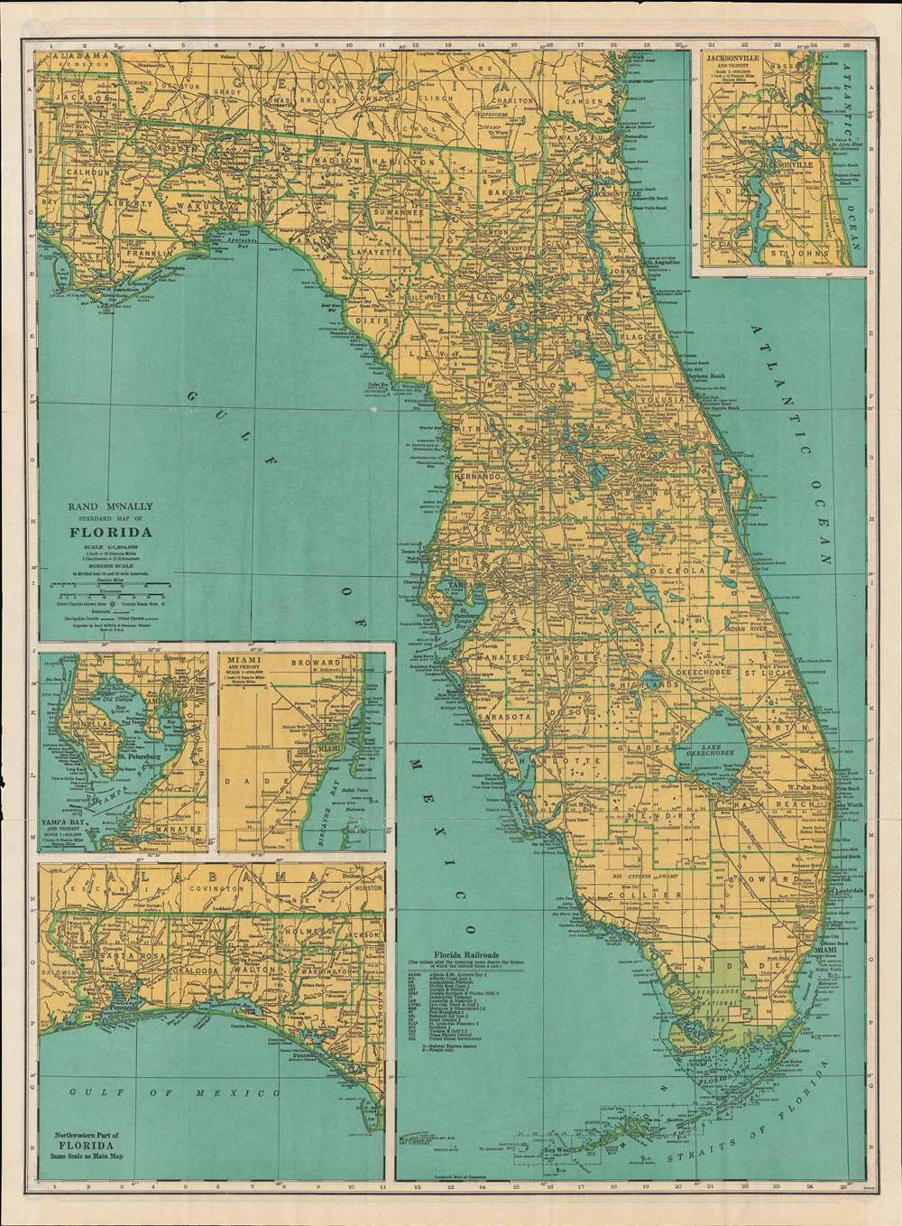
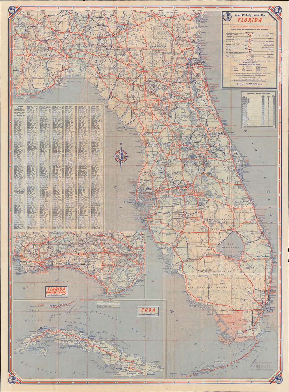
An uncommon 1950 Rand McNally Map of Florida. Printed on both sides, the map combines Rand McNally's Standard Map of Florida on the recto, detailing towns, cities, and political divisions, with their Road Map Florida on the verso, focusing on roads and highways. The 'standard' map includes insets of Jacksonville, Tampa Bay, Miami, and the Florida panhandle. The 'road' map also details the panhandle, but has a further inset extending the map's coverage to Cuba, underscoring the active communication between Cuba and Florida before the 1961 Cuban Missile Crises closed the borders.
Publication History and Census
This map was printed by Rand McNally. The map is undated, but census data dating to 1950 allows us to put an approximate date on the piece. Examples of this map appear as early as the 1920s and it was regularly updated in the subsequent decades.Cartographer
Rand, McNally and Co. (fl. 1856 - present) is an American publisher of maps, atlases and globes. The company was founded in 1856 when William H. Rand, a native of Quincy, Massachusetts, opened a print shop in Chicago. Rand hired the recent Irish immigrant Andrew McNally to assist in the shop giving him a wage of 9 USD per week. The duo landed several important contracts, including the Tribune's (later renamed the Chicago Tribune) printing operation. In 1872, Rand McNally produced its first map, a railroad guide, using a new cost effective printing technique known as wax process engraving. As Chicago developed as a railway hub, the Rand firm, now incorporated as Rand McNally, began producing a wide array of railroad maps and guides. Over time, the firm expanded into atlases, globes, educational material, and general literature. By embracing the wax engraving process, Rand McNally was able to dominate the map and atlas market, pushing more traditional American lithographic publishers like Colton, Johnson, and Mitchell out of business. Eventually Rand McNally opened an annex office in New York City headed by Caleb S. Hammond, whose name is today synonymous with maps and atlases, and who later started his own map company, C. S. Hammond & Co. Both firms remain in business. More by this mapmaker...
Condition
Very good. Light wear on old fold lines. Printed on both recto and verso. Minor verso reinforcement along old fold lines.