
1936 Florida State Road Department Road Map of Florida


This item has been sold.
Official Road Map of Florida.
Decorative Florida.
Choose a Collection:
- Digital Map Information
- Suitable for large format printing
- Full resolution TIFF file
- ICC color profile embedded
- Delivered instantly via download link
This Item
Enquire
Decorative Florida.
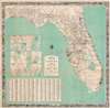
This is a 1936 Florida State Road Department map of Florida. Red lines highlight U.S. highway routes and solid black lines mark paved roads. Eleven inset city plans detail various cities, including Orlando, Tallahassee, Daytona Beach, Tampa, St. Petersburg, and Miami. An index of counties, cities, and towns appears in the lower left. The whole is surrounded by a pictorial border consisting of vignette views. Among these are the Bok Tower, beaches, hunters, and athletes playing tennis and golf. Florida wildlife, such as alligators, deer, and a puma, also appear.Publication History and Census
This map was published by the Florida State Road Department in 1936. It is well represented in institutional collections.Condition
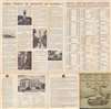
Very good. Exhibits light wear and toning along original fold lines. Verso repair to a fold separation. Text on verso.
References
OCLC 38570300.